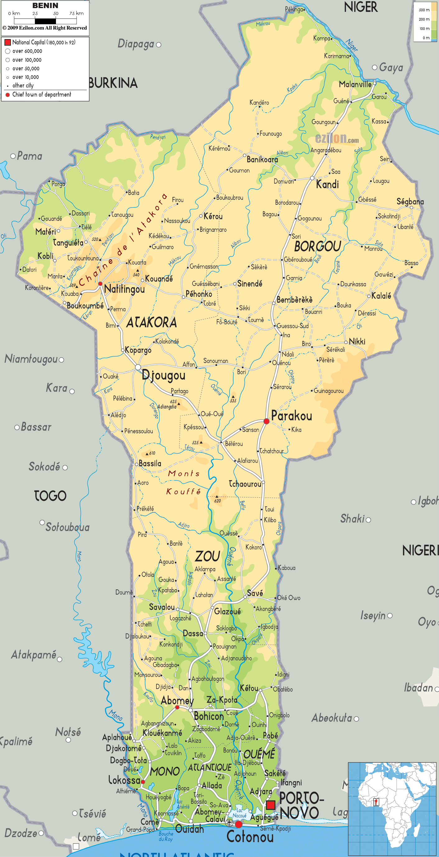
Description: The Physical Map of Benin showing major geographical features like elevations, mountain ranges, deserts, Ocean, lakes, plateaus, peninsulas, rivers, plains, landforms and other topographic features.
 Benin
is a country located in West Africa. The country sits
between the Tropic of Cancer and the Equator. The
country lies between north latitude 6.30 and 12.30
degrees and east longitude 1 and 3.40 degrees. The total
area covered by the country is 112622 square kilometres.
The country is bordered by the Bight of Benin in the
Atlantic Ocean to the south.
Benin
is a country located in West Africa. The country sits
between the Tropic of Cancer and the Equator. The
country lies between north latitude 6.30 and 12.30
degrees and east longitude 1 and 3.40 degrees. The total
area covered by the country is 112622 square kilometres.
The country is bordered by the Bight of Benin in the
Atlantic Ocean to the south.
The country can be separated in to 4 parts: the low
lying coastal area, southern plateaus, flatlands and
Atacora Mountain Range. The coastal area is an area with
an average height of 10 metres above sea level and is
full of lakes and lagoons.
The southern plateaus are cut by the valleys formed by
the major rivers: Zou, Couffo and Oueme.
The flat lands consist of dry plains and a few rolling hills. The Atacora Mountain Range sits near the northwest border of the country and also has the highest peak of the country known as Mont Sokbaro which is 658 metres tall. The lowest point however sits in the south under the Atlantic Ocean.
The longest river crossing the country is the Niger as
it empties itself into the Atlantic Ocean. It is the
third longest river in the continent and flows along for
4180 kilometres.

Political Map of Benin
Political map and map image of Benin.

Road Map of Benin
Road map and map image of Benin.

Regional Directory of United States of America
Information and guide about United States of America and websites with American topics.

Regional Directory of Europe
Information and guide about Europe and websites with European topics.

Regional Directory of Australia
Information and guide about Australia and websites with Australian topics.