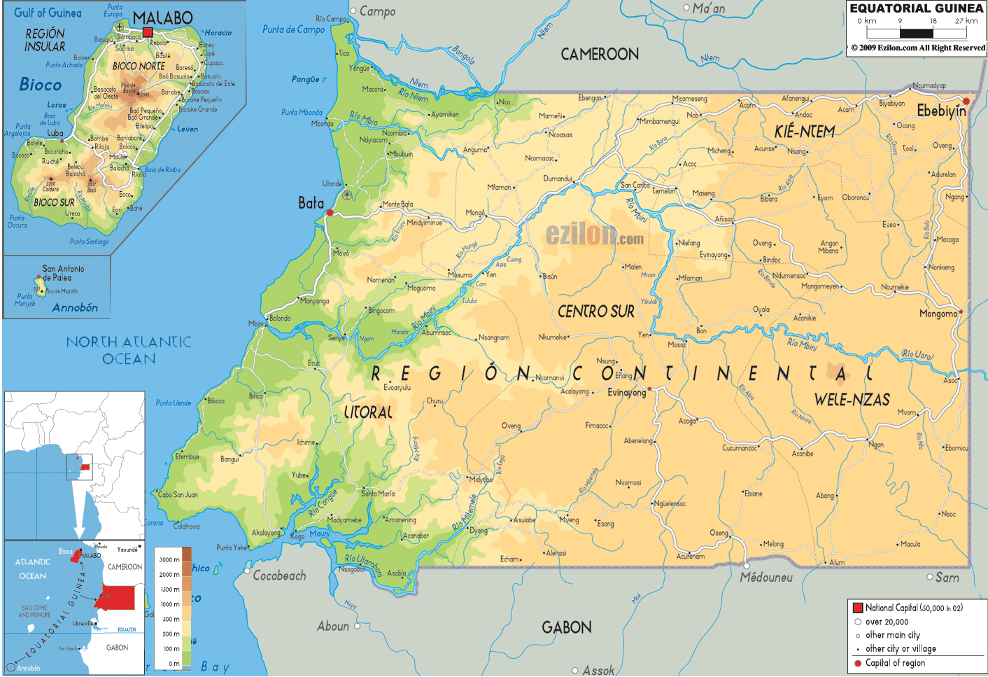
Description: The Physical Map of Equatorial Guinea showing major geographical features like elevations, mountain ranges, deserts, Ocean, lakes, plateaus, peninsulas, rivers, plains, landforms and other topographic features.
 The
Republic of Equatorial Guinea is situated in west
central Africa. The country cover 28051 square
kilometers of land and has a combined coastline of 269
kilometers. The country lies between north latitude 2
degrees and east longitude 10 degrees. Pico Basile is
the highest point in the country which measures in at
3008 meters above sea level. Meanwhile the lowest point
lies within the Atlantic Ocean. There are several rivers
in the country of which the Uola is the longest.
The
Republic of Equatorial Guinea is situated in west
central Africa. The country cover 28051 square
kilometers of land and has a combined coastline of 269
kilometers. The country lies between north latitude 2
degrees and east longitude 10 degrees. Pico Basile is
the highest point in the country which measures in at
3008 meters above sea level. Meanwhile the lowest point
lies within the Atlantic Ocean. There are several rivers
in the country of which the Uola is the longest.
The boot shaped island on the Gulf of Guinea has two
high volcanic peaks separated by a narrow valley which
cuts the island in two. The Crystal Mountain Range on
Rio Muni Island is also a long and high range which is
watered by the Rio Benito River.

Political Map of Equatorial Guinea
Political map and map image of Equatorial Guinea.

Road Map of Equatorial Guinea
Road map and map image of Equatorial Guinea.

Regional Directory of United States of America
Information and guide about United States of America and websites with American topics.

Regional Directory of Europe
Information and guide about Europe and websites with European topics.

Regional Directory of Australia
Information and guide about Australia and websites with Australian topics.