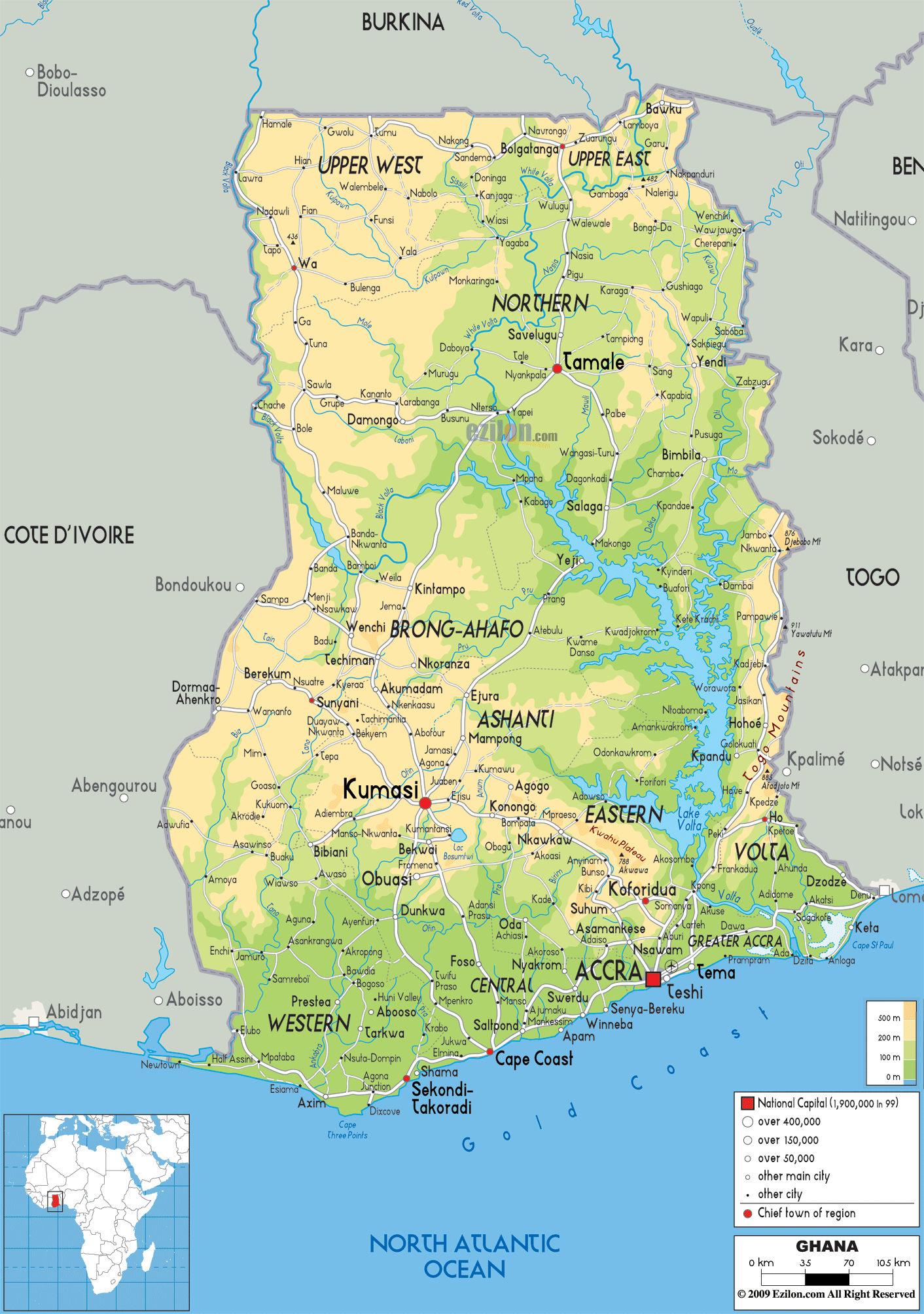
Description: The Physical Map of Ghana showing major geographical features like elevations, mountain ranges, deserts, Ocean, lakes, plateaus, peninsulas, rivers, plains, landforms and other topographic features.
 Ghana
is a country situated in the African continent. It sits
by the Gulf of Guinea. The country lies between north
latitude 8 degrees and 2 degrees west longitude. Sitting
just a little north of the Equator the area experiences
hot and humid weather conditions with regular rainfall.
Ghana
is a country situated in the African continent. It sits
by the Gulf of Guinea. The country lies between north
latitude 8 degrees and 2 degrees west longitude. Sitting
just a little north of the Equator the area experiences
hot and humid weather conditions with regular rainfall.
The topography of the country sports plains, hills,
rivers and lakes. Lake Volta is the largest lake in the
country and the largest manmade lake in the world.
It is a peak present in the Akwapim-Togo Mountain Range.
The lowest point is on the Atlantic Ocean. Most of south central Ghana is taken up by the Volta Basin.
The Oti and Afram are the two major tributaries of
rivers which flow into Lake Volta. The total area taken
up by the country is 238533 square kilometers of which
3.5% is water and the rest is land. The south central
area of the country is taken up by the Kwahu Plateau.
The coastline measures in at 537 kilometers. The coast
is cut across by many rivers and small streams which
make navigation a pain.

Political Map of Ghana
Political map and map image of Ghana.

Road Map of Ghana
Road map and map image of Ghana.

Regional Directory of United States of America
Information and guide about United States of America and websites with American topics.

Regional Directory of Europe
Information and guide about Europe and websites with European topics.

Regional Directory of Australia
Information and guide about Australia and websites with Australian topics.