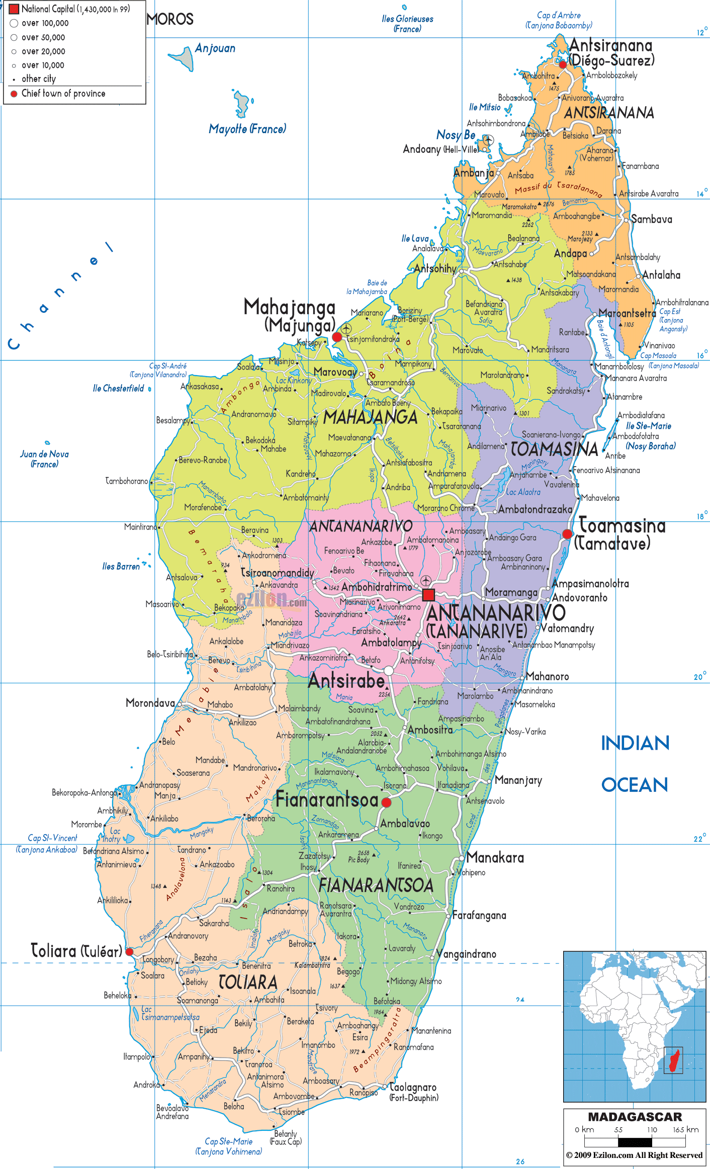
Description: Detailed large political map of Madagascar showing names of capital cities, towns, states, provinces and boundaries with neighbouring countries.
 Republic
of Madagascar, or Madagascar, as it is commonly referred
to as is an Island nation located off the southeastern
coats of Africa. The main Island is not just the fourth
largest island worldwide but it also has about five
percent of the world's animal species and plants. The
main Island is also referred to as Madagascar. The
country is the 46th-largest nation in the world and it
is a little bigger than France. There are certain plants
and animals in Madagascar that you will not find
anywhere else in the world. Sometimes, ecologists refer
to this nation as the "eight continent".
Republic
of Madagascar, or Madagascar, as it is commonly referred
to as is an Island nation located off the southeastern
coats of Africa. The main Island is not just the fourth
largest island worldwide but it also has about five
percent of the world's animal species and plants. The
main Island is also referred to as Madagascar. The
country is the 46th-largest nation in the world and it
is a little bigger than France. There are certain plants
and animals in Madagascar that you will not find
anywhere else in the world. Sometimes, ecologists refer
to this nation as the "eight continent".
The people from Madagascar are called Malagasy.

Physical Map of Madagascar
Physical map and map image of Madagascar.

Road Map of Madagascar
Road map and map image of Madagascar.

Regional Directory of United States of America
Information and guide about United States of America and websites with American topics.

Regional Directory of Europe
Information and guide about Europe and websites with European topics.

Regional Directory of Australia
Information and guide about Australia and websites with Australian topics.