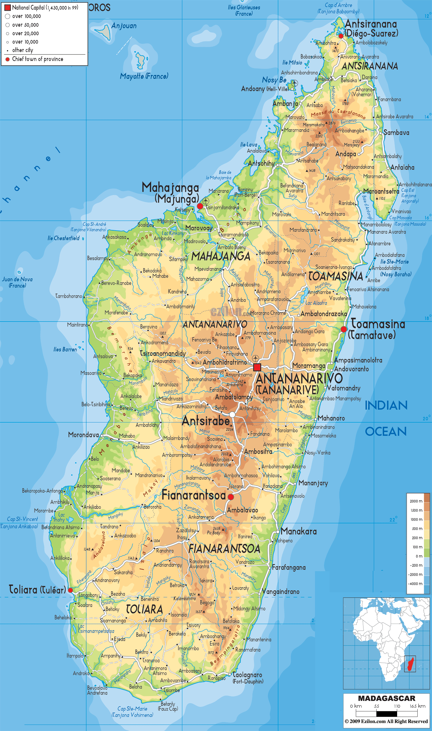
Description: The Physical Map of Madagascar showing major geographical features like elevations, mountain ranges, deserts, Ocean, lakes, plateaus, peninsulas, rivers, plains, landforms and other topographic features.
 Madagascar
or the Republic of Madagascar is an island-country which
is located in the Indian Ocean, off the Southeast
African coast. The country consists of the island of
Madagascar and several other peripheral islands.
Madagascar
or the Republic of Madagascar is an island-country which
is located in the Indian Ocean, off the Southeast
African coast. The country consists of the island of
Madagascar and several other peripheral islands.
It is considered the 4th largest island in the world.
Madagascar is a popular hotspot for biodiversity as 90
percent of its wildlife is not found anywhere else on
this planet.
The country covers an area of about 600,000 square
kilometres. The country's highest peaks are present
within three highland massifs: Maromokotro stands at
2,876 metres in the Tsaratanana Massif. Boby Peak at
2,658 metres in the Andringitra Massif is the second
highest point.
In the east, there is a chain of man-made as well as
natural lakes known as the Canal des Pangalanes. All of
them are connected by canals which were built by the
French long time back. The western and southern sideslie
in the rain-shadow region of the central highlands.
They are full of spiny forests, dry deciduous forests,
deserts and shrublands. The western coast of Madagascar
comprises of many protected harbors which are prone to
silting due high levels of erosion carried by rivers
flowing from the western plains.

Political Map of Madagascar
Political map and map image of Madagascar.

Road Map of Madagascar
Road map and map image of Madagascar.

Regional Directory of United States of America
Information and guide about United States of America and websites with American topics.

Regional Directory of Europe
Information and guide about Europe and websites with European topics.

Regional Directory of Australia
Information and guide about Australia and websites with Australian topics.