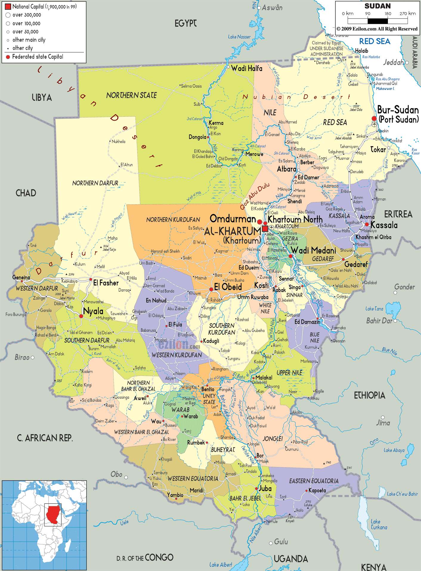
Description: Detailed large political map of Sudan showing names of capital cities, towns, states, provinces and boundaries with neighbouring countries.
 Sudan,
or the Republic of the Sudan as it is officially
referred to as, is situated in the northeastern Africa.
It is the largest nation in this continent and also in
the Arab. In terms of the land area, Sudan is considered
to be the 10th largest nation in the world. On the north
of this country there is Egypt, on its southwest there
are the Central African Republic and Congo, on the
southeast it is bordered by Uganda and Kenya, on its
east it is surrounded by Ethiopia and Eritrea; and it
has the Red Sea on its northeast. River Nile, the
longest river on the planet, bisects this nation from
south to north.
Sudan,
or the Republic of the Sudan as it is officially
referred to as, is situated in the northeastern Africa.
It is the largest nation in this continent and also in
the Arab. In terms of the land area, Sudan is considered
to be the 10th largest nation in the world. On the north
of this country there is Egypt, on its southwest there
are the Central African Republic and Congo, on the
southeast it is bordered by Uganda and Kenya, on its
east it is surrounded by Ethiopia and Eritrea; and it
has the Red Sea on its northeast. River Nile, the
longest river on the planet, bisects this nation from
south to north.

Physical Map of Sudan
Physical map and map image of Sudan.

Road Map of Sudan
Road map and map image of Sudan.

Regional Directory of United States of America
Information and guide about United States of America and websites with American topics.

Regional Directory of Europe
Information and guide about Europe and websites with European topics.

Regional Directory of Australia
Information and guide about Australia and websites with Australian topics.