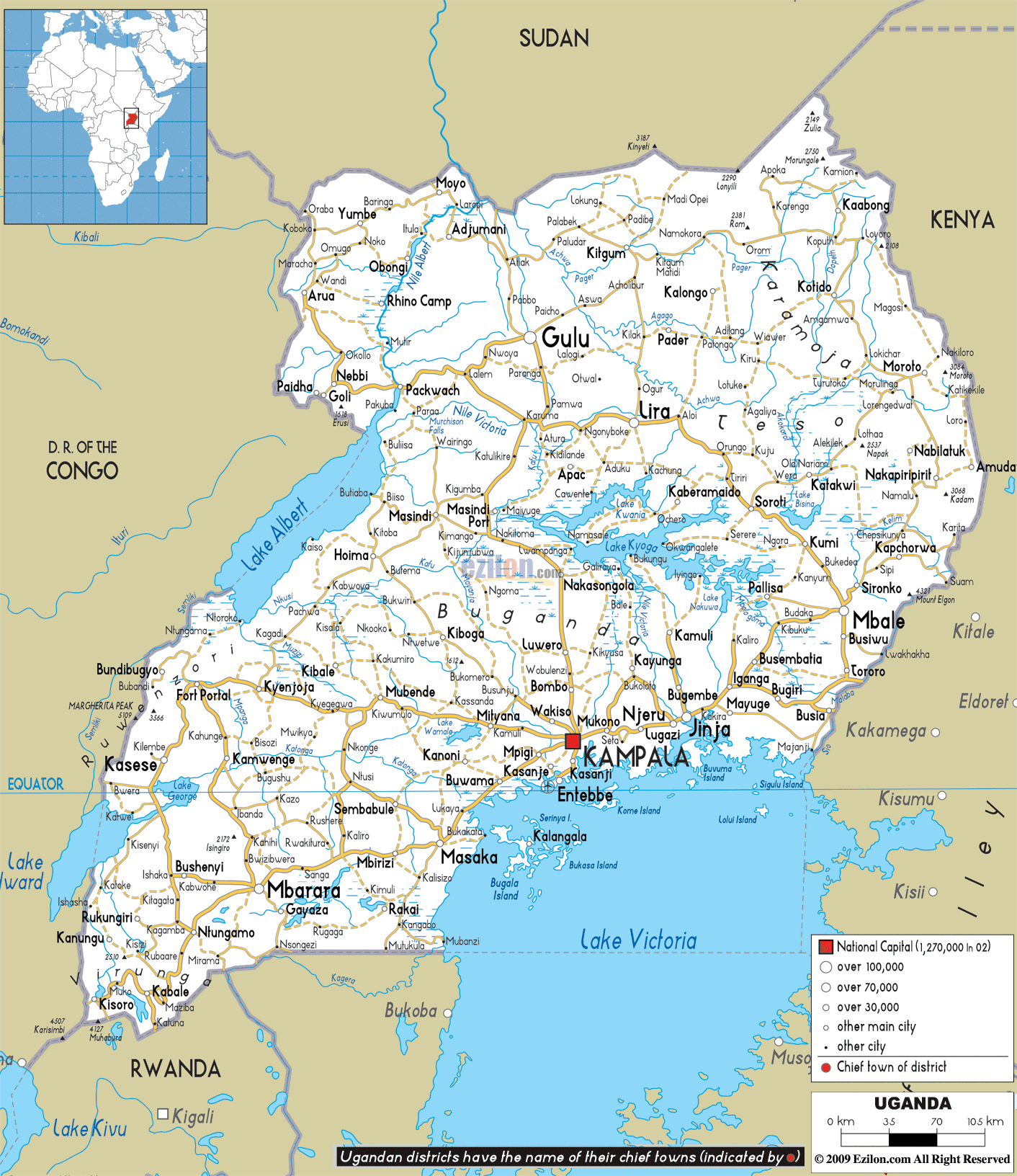

Description: Detailed clear large road map of Uganda with road routes from cities to towns, road intersections to provinces and perfectures.
 Uganda,
or the Republic of Uganda as it is commonly referred to
as, is a nation that is located in the East Africa. On
the west of the country it is bordered by the Democratic
Republic of the Congo and on its east it is bordered by
Kenya. Tanzania is located on the south of Uganda and
Sudan is located on its north. This country may be
landlocked, but Uganda also has many big lakes. Some of
the lakes here are Lake Edward, Lake Victoria, Lake
Albert and Lake George. There are eighty districts in
Uganda and these districts are located on the east,
west, north and central Uganda.
There are people of different ethnicities living in
Uganda and the people in the country make use of about
forty languages. After it achieved independence,
Uganda's official language became English. The second
official language was approved in the year 2005 and this
language is Swahili. This language is widely used in the
Central East Africa and East Africa. Most of the people
living in Uganda are Christians. In fact, more than
eighty percent of the people here follow Christianity
and most of them are Roman Catholics. Islam is also one
other religion that is followed by the population of
Uganda.

Physical Map of Uganda
Physical map and map image of Uganda.

Political Map of Uganda
Political map and map image of Uganda.

Regional Directory of United States of America
Information and guide about United States of America and websites with American topics.

Regional Directory of Europe
Information and guide about Europe and websites with European topics.

Regional Directory of Australia
Information and guide about Australia and websites with Australian topics.