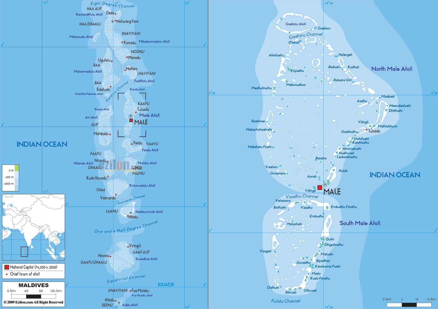
Description: The Physical Map of Maldives showing major geographical features like elevations, ocean, lakes, plateaus, peninsulas, rivers, plains, landforms and other topographic features.
 Maldives
officially is called the Republic of the Maldives. It is
an island located in the Indian Ocean. It has a
twenty-six atolls’ double chain running from north to
south.
Maldives
officially is called the Republic of the Maldives. It is
an island located in the Indian Ocean. It has a
twenty-six atolls’ double chain running from north to
south.
It is situated between the Chagos Archipelago and
Minicoy Island. It is group of 1,192 coral islands
spread in the north south direction. 90,000 square
kilometres is the approx area of the country. It is one
of the most dispersed countries of the world. Sand bars
and live coral reefs is the most prominent feature of
this island nation. It rises from the depths of the
Indian Ocean and runs 960 kilometres long.
The total length of the road is fourteen kilometres. In
the world the lowest country is Maldives with the height
of 1.5 metres above sea level with 2.4 metres as the
maximum ground level.

Political Map of Maldives
Political map and map image of Maldives.

Regional Directory of Asia
Information and guide about Asia and websites with Asian topics.

Regional Directory of United States of America
Information and guide about United States of America and websites with American topics.

Regional Directory of Europe
Information and guide about Europe and websites with European topics.

Regional Directory of Australia
Information and guide about Australia and websites with Australian topics.