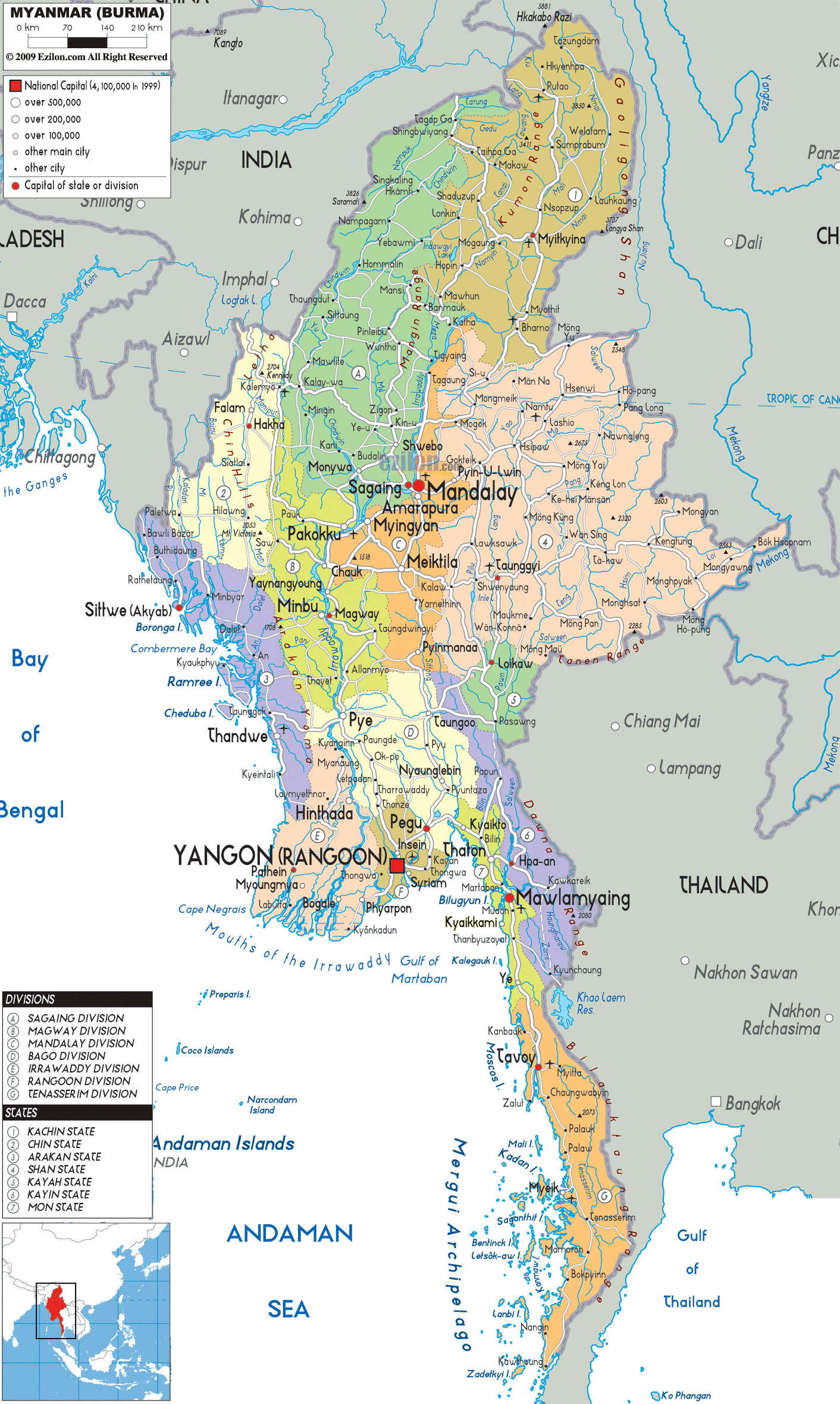
Description: Detailed large political map of Myanmar showing names of capital city, towns, states, provinces and boundaries with neighbouring countries.
 Myanmar,
often referred to as Burma, is the largest county (by
geographical area) in the Southeast Asia. On the
northeast of Myanmar lies China and on its east lies
Laos. It is the 40th largest country on earth with an
area of 678,500 square kilometers. It is also the
largest nation in the mainland Southeast Asia. Myanmar
is one of the poorest countries in Southeast Asia, as it
has been suffering from mismanagement, stagnation and
isolation.
Myanmar,
often referred to as Burma, is the largest county (by
geographical area) in the Southeast Asia. On the
northeast of Myanmar lies China and on its east lies
Laos. It is the 40th largest country on earth with an
area of 678,500 square kilometers. It is also the
largest nation in the mainland Southeast Asia. Myanmar
is one of the poorest countries in Southeast Asia, as it
has been suffering from mismanagement, stagnation and
isolation.
As the economic growth of the country is
slow, this has led to the conservation of its
environment and ecosystems. About half of the country is
covered with forests that consist of mangrove, ironwood,
acacia, rubber, michelia champaca coconut, etc. When it
was under the administration of the British, Myanmar was
considered to be a wealthy nation in the Southeast Asia.
Burmese is not just the official language of Myanmar but
it is also the mother tongue of the Bamar. Most of the
people living in Myanmar are Buddhists but there are
also Christians and Muslims in the country. The culture
of this nature is wide ranging. However, the chief
cultures of Myanmar are Buddhist and Bamar. The country
has about fifty-six million people living in its land.

Physical Map of Myanmar
Physical map and map image of Myanmar.

Road Map of Myanmar
Road map and map image of Myanmar.

Regional Directory of United States of America
Information and guide about United States of America and websites with American topics.

Regional Directory of Europe
Information and guide about Europe and websites with European topics.

Regional Directory of Australia
Information and guide about Australia and websites with Australian topics.