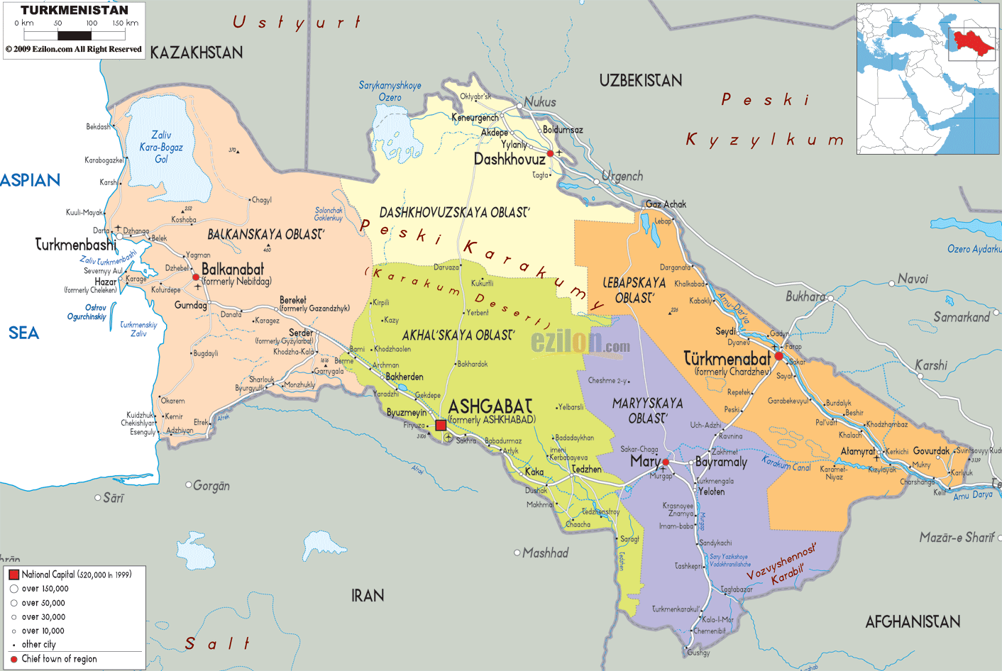
Description: Detailed large political map of Turkmenistan showing names of capital city, towns, states, provinces and boundaries with neighbouring countries.
 Turkmenistan
is basically a nation that is situated in the central
Asia. This Turkic nation used to be a part of the
republic of the Soviet Union. On the west of
Turkmenistan, the country is bordered by the Caspian
Sea, on its northwest it share border with Kazakhstan,
on its northeast it is bordered by Uzbekistan, it has
Iran on the southwest and Afghanistan on the southeast.
The term ‘Turkmenistan’ means ‘land of the Turkmen’ in
Persian. Ashgabat is the capital city of this country
and it means the City of Arsaces. Turkmenistan is one
among the world’s driest deserts. The Karakum Desert
covers about 4/5th of the country.
Turkmenistan
is basically a nation that is situated in the central
Asia. This Turkic nation used to be a part of the
republic of the Soviet Union. On the west of
Turkmenistan, the country is bordered by the Caspian
Sea, on its northwest it share border with Kazakhstan,
on its northeast it is bordered by Uzbekistan, it has
Iran on the southwest and Afghanistan on the southeast.
The term ‘Turkmenistan’ means ‘land of the Turkmen’ in
Persian. Ashgabat is the capital city of this country
and it means the City of Arsaces. Turkmenistan is one
among the world’s driest deserts. The Karakum Desert
covers about 4/5th of the country.

Physical Map of Turkmenistan
Physical map and map image of Turkmenistan.

Road Map of Turkmenistan
Road map and map image of Turkmenistan.

Regional Directory of United States of America
Information and guide about United States of America and websites with American topics.

Regional Directory of Europe
Information and guide about Europe and websites with European topics.

Regional Directory of Australia
Information and guide about Australia and websites with Australian topics.