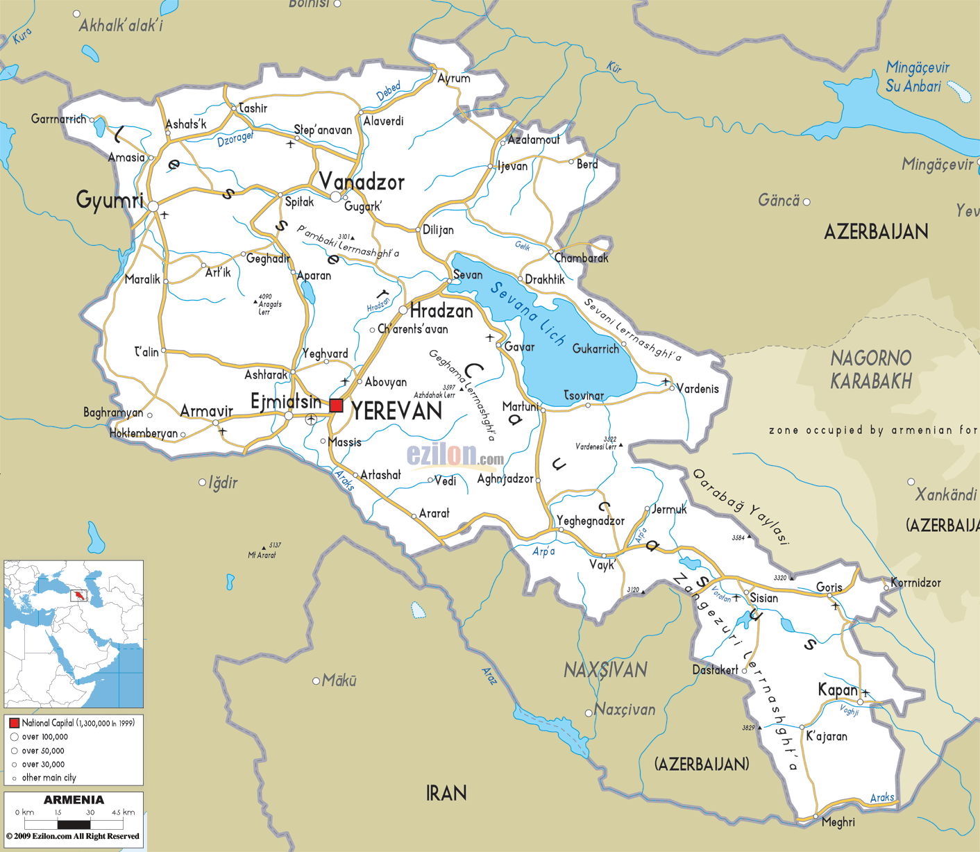
Description: Detailed clear large road map of Armenia with road routes from cities to towns, road intersections to regions, provinces, prefectures with routes leading to neighboring countries.
 The roads network in Armenia, connecting several cities, towns and villages, can be seen in the above map.
Main road from North Eastern part of the border town of Ashats'k pass down to Gyumri city, this road connects towns in the south such as Maralik, T'alin, Ejimiatsin, Armavir, Yerevan, Massis, Artashat and Ararat.
Major road in the North that intersect at Dilijan, continues all the way to Sevan, Gavar, Martuni, Aghjadzor, Vayk to Goris near the border to Azerbaijan,
Smaller road extend from this South Eastern road such as Kapan, K'ajaran to Meghri a border down with Iran in the south. .

Politica Map of Armenia
Political map and map image of Armenia.

Physical Map of Armenia
Physical map and map image of Armenia.

Regional Directory of United States of America
Information and guide about United States of America and websites with American topics.

Regional Directory of Europe
Information and guide about Europe and websites with European topics.

Regional Directory of Australia
Information and guide about Australia and websites with Australian topics.