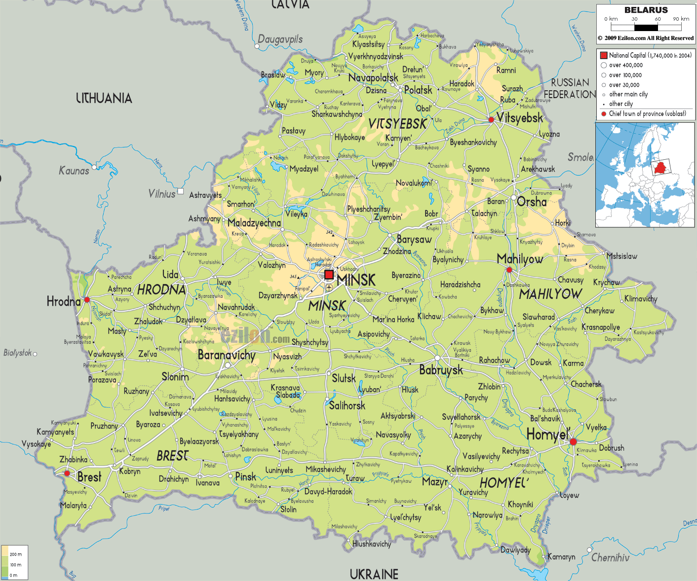
Description: The Physical Map of Belarus showing major geographical features like elevations, lakes, plateaus, peninsulas, rivers, plains, landforms and other topographic features.
 The
Republic of Azerbaijan is located in the Caucasus
meeting point of Europe and Asia which is also called
Eurasia. It is situated in the place where Western Asia
and Eastern Europe share their borders.
The
Republic of Azerbaijan is located in the Caucasus
meeting point of Europe and Asia which is also called
Eurasia. It is situated in the place where Western Asia
and Eastern Europe share their borders.
It is bordered by Russia in the north, Georgia in the
northwest, Armenia in the west, Iran in the south and
the Caspian Sea in the east. It also shares a small
border with Turkey to the northwest.
The country is situated between latitudes 38 and 42 degrees north and 44 and 51 degrees east longitudes. The land area measures up at 400 kilometres from top to bottom and 500 kilometres from east to west. The unique terrain of Azerbaijan is dominated by highlands, flat lands and even by sea. The Caspian Sea forms a coastline to the east which stretches as long as 800 kilometres.
The most dominant mountain range in the country is located in the north and is called the Greater Caucasus Mountains. The centre of the country is dominated by massive flat lands. The other important mountain ranges are the Lesser Caucasus and Talysh ranges. Mount Bazarduzu is the highest point in the country and stands tall at 4466 meters. Kur is the longest river in the country and it measures to be 1515 kilometres long.

Political Map of Belarus
Political map and map image of Belarus.

Road Map of Belarus
Road map and map image of Belarus.

Regional Directory of United States of America
Information and guide about United States of America and websites with American topics.

Regional Directory of Europe
Information and guide about Europe and websites with European topics.

Regional Directory of Australia
Information and guide about Australia and websites with Australian topics.