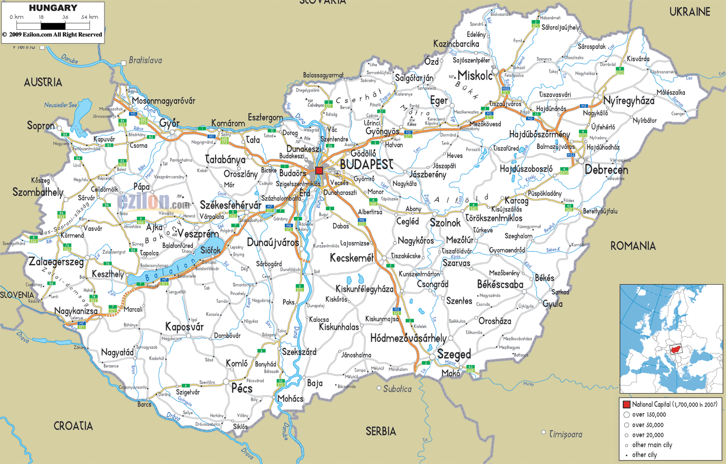
Description: Detailed clear large road map of Hungary with road routes from cities to towns, road intersections in regions, provinces, prefectures, also with routes leading to neighboring countries.
 Central state roads Motorways in Hungary are divided into motorways and expressways with motorways such as : M0 - M1 - M15 - M2 - M3 - M30 - M31 - M35 - M43 - M5 - M6 - M60 - M7 - M70 - M85 - M86 crossing or extending into Northern, Central, Eastern and Western Hungary.
Roads from Budapest: Almost all the important roads and highways converge in the capital city of Budapest on the North Central part of the country. One axis of the road passed through Budaörs town, Tatabánya, Gyor, Komárom to the North West town of Mosonmagyaróvár almost near to the border with Austria.
M7 motorway from Budapest goes down to the southwest border town of Nagykanizsa, while passing through Siófok, Balaton lake and Székesfehérvár.
M5/E75 goes southbound through the Hungarian Great Plain and south-eastern regions of the country via the cities of Kecskemét, Kiskunfelegyhaza to Szeged near the boder town of Mako.
M3 motorway is a Hungarian motorway connecting Budapest with several cities and towns in the North East and terminates at Nyíregyháza almost near the border with Ukraine, also connects down to Debrecen near Romania.

Physical Map of Hungary
Physical map and map image of Hungary.

Political Map of Hungary
Political map and map image of Hungary.

Regional Directory of United States of America
Information and guide about United States of America and websites with American topics.

Regional Directory of Europe
Information and guide about Europe and websites with European topics.

Regional Directory of Australia
Information and guide about Australia and websites with Australian topics.