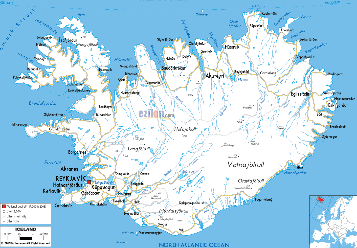
Description: Detailed clear large road map of Iceland with road routes from cities to towns, road intersections in regions, provinces, prefectures, also with routes leading to neighboring countries.
 The national highway system comprises of primary, secondary, local access and highway roads managed by Icelandic Road Administration.
The road network is numbered in a single, double and 3 digit numbers such 1, 22, and 550 to name but a few. Driving in Iceland is on the right with overtaking on the left. Roads in Iceland connect through the coastal towns around the country since most of the land in the center is mountainous.
1 main road connects through Reykjavík heading northwards to cities such as Borgarnes, Blönduós, Akureyri, Egilsstaðir down to the southern cities of Höfn, Vík, Hella and it way through Selfoss back again to Reykjavík. This route for a round trip is a very long one, but ideal for travelers traveling around the country as you can see from the map above.
Also there are excellent road network connecting to south of Reykjavík to coastal cities and towns of Kópavogur, Hafnarfjordur, Keflavik, Grindavík, Thorlakshofn and to Selfos.

Physical Map of Iceland
Physical map and map image of Iceland.

Political Map of Iceland
Political map and map image of Iceland.

Regional Directory of United States of America
Information and guide about United States of America and websites with American topics.

Regional Directory of Europe
Information and guide about Europe and websites with European topics.

Regional Directory of Australia
Information and guide about Australia and websites with Australian topics.