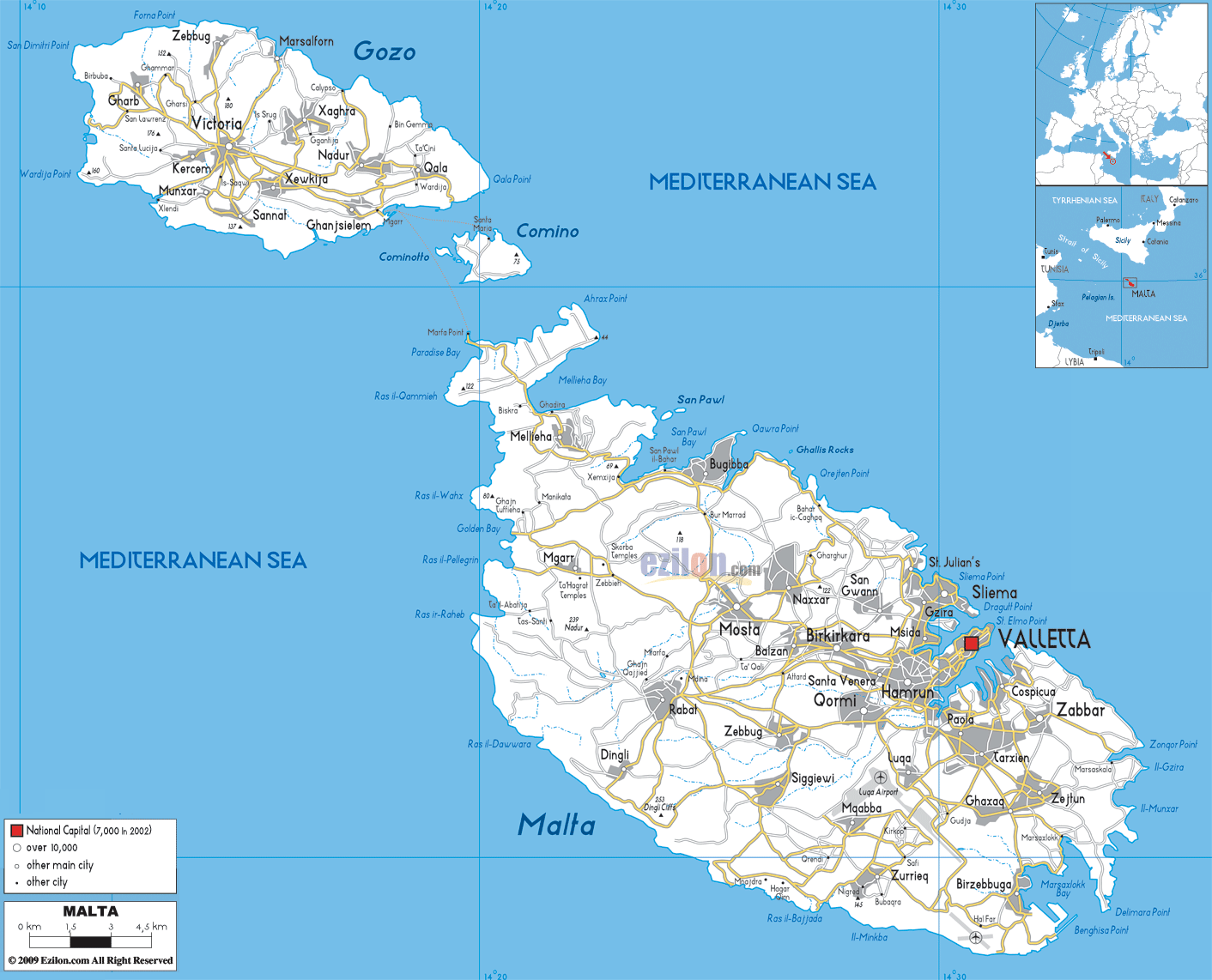
Description: Detailed clear large road map of Malta with road routes and driving directions from cities to towns, road intersections in regions, provinces, prefectures, also with routes leading to neighboring countries.
 There are several roads in Malta leading to various localities, towns and villages as can be seen in the road map above. Drivers, drive on the right and overtake on the left.
Malta Main Roads and Highways are as follows: 1 Attard - 2 Balzan - 3 Birgu - 4 Birkirkara 5 Birzebbuga - 6 Bormla - 7 Dingli - 8 Fgura 9 Floriana - 10 Gharghur - 11 Ghaxaq - 12 Gudja 13 Gzira - 14 Hamrun - 15 Iklin - 16 Kalkara 17 Kirkop - 18 Lija - 19 Luqa- 20 Marsa, Malta 21 Marsaskala - 22 Marsaxlokk - 23 Mdina 24 Mellieha - 25 Mgarr - 26 Mosta - 27 Mqabba
Highest concentration of roads and highways can be seen leading into Valletta, Hamrun, Zabbar, Birkirkara and Qormi located in the southern Island of Malta. There are well connected roads in Gozo linking Victoria in the center to Xaghra, Zebbug and Qala .

Physical Map of Malta
Physical map and map image of Malta.

Political Map of Malta
Political map and map image of Malta.

Regional Directory of United States of America
Information and guide about United States of America and websites with American topics.

Regional Directory of Europe
Information and guide about Europe and websites with European topics.

Regional Directory of Australia
Information and guide about Australia and websites with Australian topics.