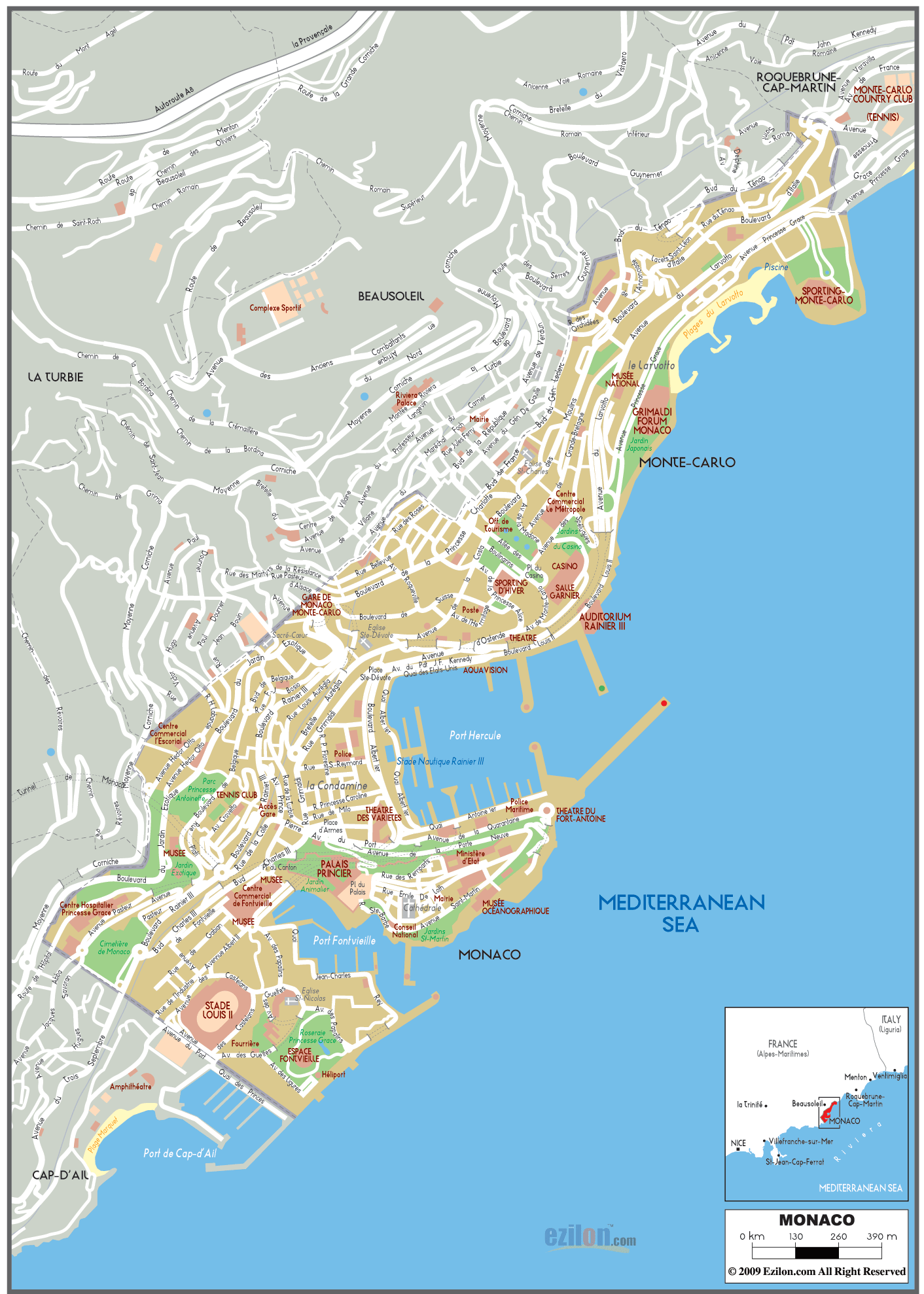
Description: Detailed large political map of Monaco showing names of streets, roads, location of important city buildings or landmarks, sea and boundaries with neighbouring countries - seen at the bottom right of the map.
 Monaco has urban roads with access to the A8 autoroute, car drivers are expected to drive on the right-hand side of the road and overtake on the left as in the U.S.
There are several intercity roads connecting many famous locations in Monaco as can be seen from the road map above.
Roads from Roquebrune-Cap-Martin in the east Ave. de France (near Monte Carlo Country Club) connects with Boulevard d'Italie.
Avenue Princess Grace connects famous Monaco heritage locations such as Sporting Monte-Carlo, Plages du Larvotto, National Museum (Musée National) and Grimaldi Forum Monaco.
Pierre Avenue and Bvd. Charles III roads also connect Centre Commercial de Fontvieille, Palais Princier (Prince's Palace of Monaco) and Théâtre des Variétés. Avenue de la Quarantaine leads to Police Maritime and Theatre Du Fort-Antoine .

Physical Map of Europe
Physical map and map image of Europe.

Political Map of Europe
Political map and map image of Europe.

Regional Directory of United States of America
Information and guide about United States of America and websites with American topics.

Regional Directory of Europe
Information and guide about Europe and websites with European topics.

Regional Directory of Australia
Information and guide about Australia and websites with Australian topics.