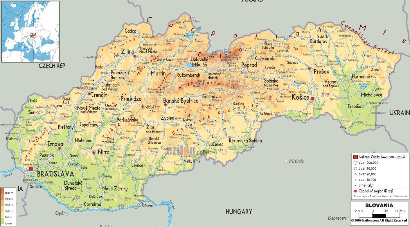
Description: The physical map of Slovakia showing major geographical features like elevations, mountain ranges, seas, lakes, plateaus, peninsulas, rivers, plains, landforms and other topographic features.
 Slovakia
is a central European country which is completely
landlocked. The country two distinct areas: Mountains in
the north and plains in the south. The country falls
between north latitude 16.5 degrees and east longitude
22.33 degrees.
Slovakia
is a central European country which is completely
landlocked. The country two distinct areas: Mountains in
the north and plains in the south. The country falls
between north latitude 16.5 degrees and east longitude
22.33 degrees.
The country covers a total area of 48845 square
kilometers of which 41% are forests. The country has
many rivers, most of which cut the county from top to
bottom.
Of all the reservoirs and lakes the Orava Lake is the
largest with a surface area of 352 square kilometers.
The Danube River is 2850 kilometers in total out of
which 172 kilometers is the Slovak Danube making it the
6thlongest river in the country.
The longest river in the country is the Vah as it flows
along for 403 kilometers and is entirely within the
Slovakian country. The other important rivers are the
Hron, Nitra, Ipel and Hornad.
The most important mountain ranges in the country are
the Tatra Mountains, Carpathian Mountains, Maple
Mountains and the Velka Fatra. The highest peak in the
country is located in the Tatra Mountains by the name of
Gerlachovsky Stit measuring in at 2655 meters. The
lowest point in the country is located under the Bodrog
River at 94 meters.

Political Map of Slovakia
Political map and map image of Slovakia.

Road Map of Slovakia
Road map and map image of Slovakia.

Regional Directory of United States of America
Information and guide about United States of America and websites with American topics.

Regional Directory of Europe
Information and guide about Europe and websites with European topics.

Regional Directory of Australia
Information and guide about Australia and websites with Australian topics.