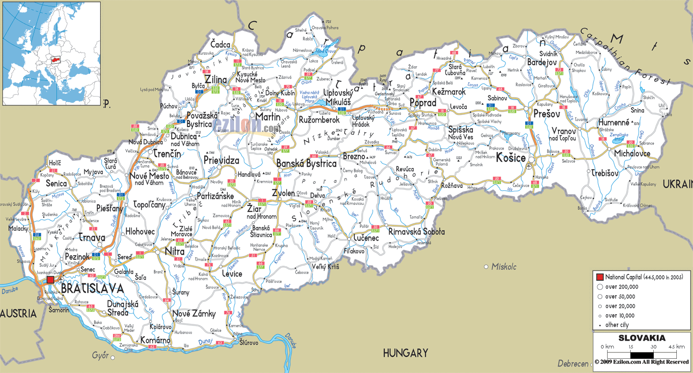
Description: Detailed clear large road map of Slovakia with road routes from cities to towns, road intersections / exit roads in regions, provinces, prefectures, also with routes leading to neighboring countries.
 Slovakia has well connected roads and highways connecting most of the country cities, towns and villages. Car drivers in Slovakia drive on the right and overtake on the left hand side.
Motorways
D1: This motorway starts from Bratislava proceeding to Trnava and to Trencín continued to Považská Bystrica - Žilina, Liptovský Mikuláš - Jánovce, Prešov - Košice - Záhor in the Slovakia, Ukraine border.
D2: Starts from Kúty in the Czech, Slovakia border - Malacky - Bratislava - Jarovce (SK/H border)
D3: Dolný Hricov - Žilina - Cadca - Skalité in Slovakia and Poland border.
D4: Jarovce - (SK/A border)

Physical Map of Slovakia
Physical map and map image of Slovakia.

Political Map of Slovakia
Political map and map image of Slovakia.

Regional Directory of United States of America
Information and guide about United States of America and websites with American topics.

Regional Directory of Europe
Information and guide about Europe and websites with European topics.

Regional Directory of Australia
Information and guide about Australia and websites with Australian topics.