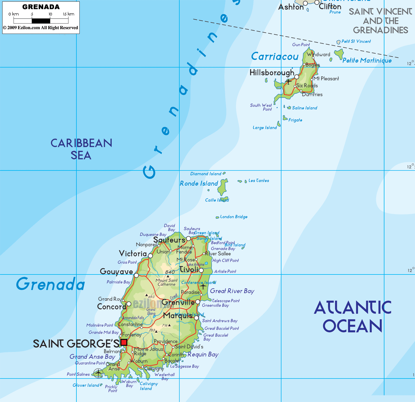
Description: The Physical Map of Grenada showing major geographical features like elevations, mountain ranges, ocean, lakes, plateaus, peninsulas, rivers, plains, landforms and other topographic features.
 Grenada
is an island country located amidst the Caribbean Sea
and the Atlantic Ocean. The geographic coordinates read
as follows: 12.07 degrees north latitude and 61.40
degrees west longitude. The total area covered by the
country is 348.5 square kilometers of which all is land.
It is also the largest island in the Grenadine Chain of
Islands. There are no inlands creeks and rivers in the
country.
Grenada
is an island country located amidst the Caribbean Sea
and the Atlantic Ocean. The geographic coordinates read
as follows: 12.07 degrees north latitude and 61.40
degrees west longitude. The total area covered by the
country is 348.5 square kilometers of which all is land.
It is also the largest island in the Grenadine Chain of
Islands. There are no inlands creeks and rivers in the
country.
The island has a volcanic origin with a rocky and
mountainous terrain. The highest point in the country is
called Mount St. Catherine and it is 840 meters from
root to tip. The lowest point however rests at the mean
sea level with the Atlantic Ocean and Caribbean Sea.
Most of the volcanic peaks on the islands are dormant
except one known as Kick 'em Jenny. The volcanic
eruptions earlier created many crater lakes of which the
Grand Etang is the largest. The climate is mostly
tropical and is frequented by the north east trade winds
brought in by the sea. The high rate of precipitation
causes many rivers to flood the central plains in the
islands.
There are also many rivers in the country most of which
are short and unimportant. The most important rivers
however are the Antione, Chemin and Great rivers.

Political Map of Grenada
Political map and map image of Grenada.

Regional Directory of Caribbean
Information and guide about Caribbean and website listing.

Regional Directory of United States of America
Information and guide about United States of America and websites with American topics.

Regional Directory of Europe
Information and guide about Europe and websites with European topics.

Regional Directory of Australia
Information and guide about Australia and websites with Australian topics.