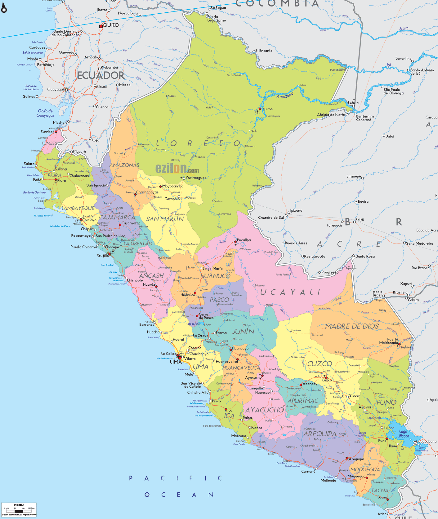
Description: Detailed large political map of Peru showing names of capital city, towns, states, provinces and boundaries with neighbouring countries.
 Peru
is located in the western South America and it has the
Pacific Ocean on its west, Chile located on its south,
Bolivia on its southeast, Brazil on its east, and
Columbia and Ecuador on its north.
Peru
is located in the western South America and it has the
Pacific Ocean on its west, Chile located on its south,
Bolivia on its southeast, Brazil on its east, and
Columbia and Ecuador on its north.
The population of Peru is about twenty-nine million and it comprises of the people of different ethnicity, such as Asians, Africans, Amerindians and Europeans. In the year 2007, this nation was declared as the 4th most populated nation in South America. The different cultures can be seen in Peru’s music, art, literature and cuisine.
More than 4/5th of the population of Peru speaks in Spanish and the language is also considered to be the main language of the nation. While Spanish is the chief language that is spoken by the people of Peru, other native languages are also spoken in the country.
The
other indigenous languages that are spoken in Peru are
many and among them, the important one is Quechua.
Basically, the culture of the country is a mixture of
Spanish and Amerindian traditions. Its culture has also
been influenced by the cultures of other ethic groups
like European, Asian and African cultures. Some of the
chief exports of Peru are fish meal, textiles, zinc,
gold and copper.

Physical Map of Peru
Physical map and map image of Peru.

Regional Directory of South America
Information and guide about South America and website listing.

Regional Directory of United States of America
Information and guide about United States of America and websites with American topics.

Regional Directory of Europe
Information and guide about Europe and websites with European topics.

Regional Directory of Australia
Information and guide about Australia and websites with Australian topics.