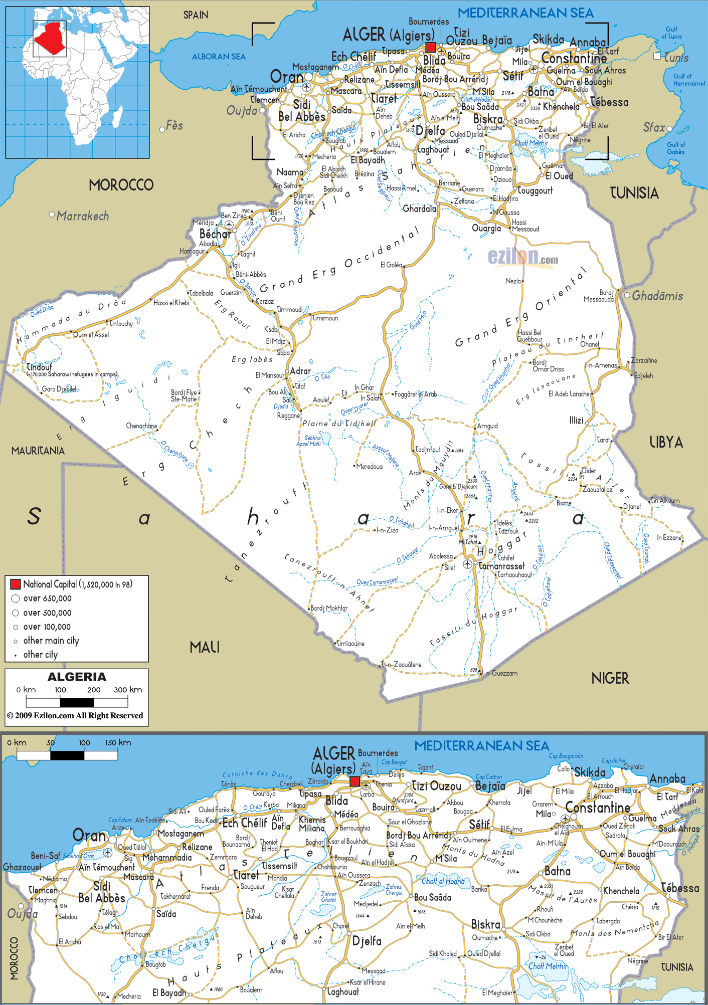
Description: Detailed clear large road map of Algeria with road routes from cities to towns, road intersections to provinces and perfectures.
 Algeria
looks out onto the Mediterranean Coast from North
Africa, bordered by Libya, Tunisia, Mali, Mauritania and
Morocco and is Africa’s second largest city with more
than 1,200 km of coastline. The striking Sahara desert
covers more than four-fifths of Algeria and the best way
to enter the desert is via the south, crossing the El
Kautara Gorges, which offer breathtaking views.
Algeria
looks out onto the Mediterranean Coast from North
Africa, bordered by Libya, Tunisia, Mali, Mauritania and
Morocco and is Africa’s second largest city with more
than 1,200 km of coastline. The striking Sahara desert
covers more than four-fifths of Algeria and the best way
to enter the desert is via the south, crossing the El
Kautara Gorges, which offer breathtaking views.
Algeria is connected by rail, road and air, it is
therefore easy to catch flights from the capital,
Algiers to other cities such as Ghardia, Djanet and
Tamanrasset, as well as to smaller towns. Within easy
reach of Algiers are some lovely beach resorts namely
Zeralda, while to the east lies the Turquoise Coast with
long beaches and rocky inlets. There is also an
excellent marina on the Sidi Fredj penisula with plenty
of sports facilities and amenities.
Tamanrasset is a popular picturesque resort both in
winter and in summer, situated in the heart of the the
Hoggar Mountains. From here most of the trekking tours
start off into the surrounding mountains and desert, it
is visited regularly by the camel caravans and
blue-robed Touaregs. The holy town of Beni-Isguen, not
far from Ghardaia, is its permanent auction market,
while the Tassili N’Ajjer or better known as the
‘Plateau of Chasms’ is another popular site, an expanse
of volcanic and massive gorges with rivers running
through, featuring neolithic-aged rock paintings.
Summers in Algeria can be very hot, especially in the
south with frequent sandstorms. In the north there is a
lot of humidity due to the sea breezes. Winters are mild
in the North and the oasis in the South offer perfect
weather conditions, although the temperature of the
desert varies considerably by day and night.

Physical Map of Algeria
Physical map and map image of Algeria.

Political Map of Algeria
Political map and map image of Algeria.

Regional Directory of United States of America
Information and guide about United States of America and websites with American topics.

Regional Directory of Europe
Information and guide about Europe and websites with European topics.

Regional Directory of Australia
Information and guide about Australia and websites with Australian topics.