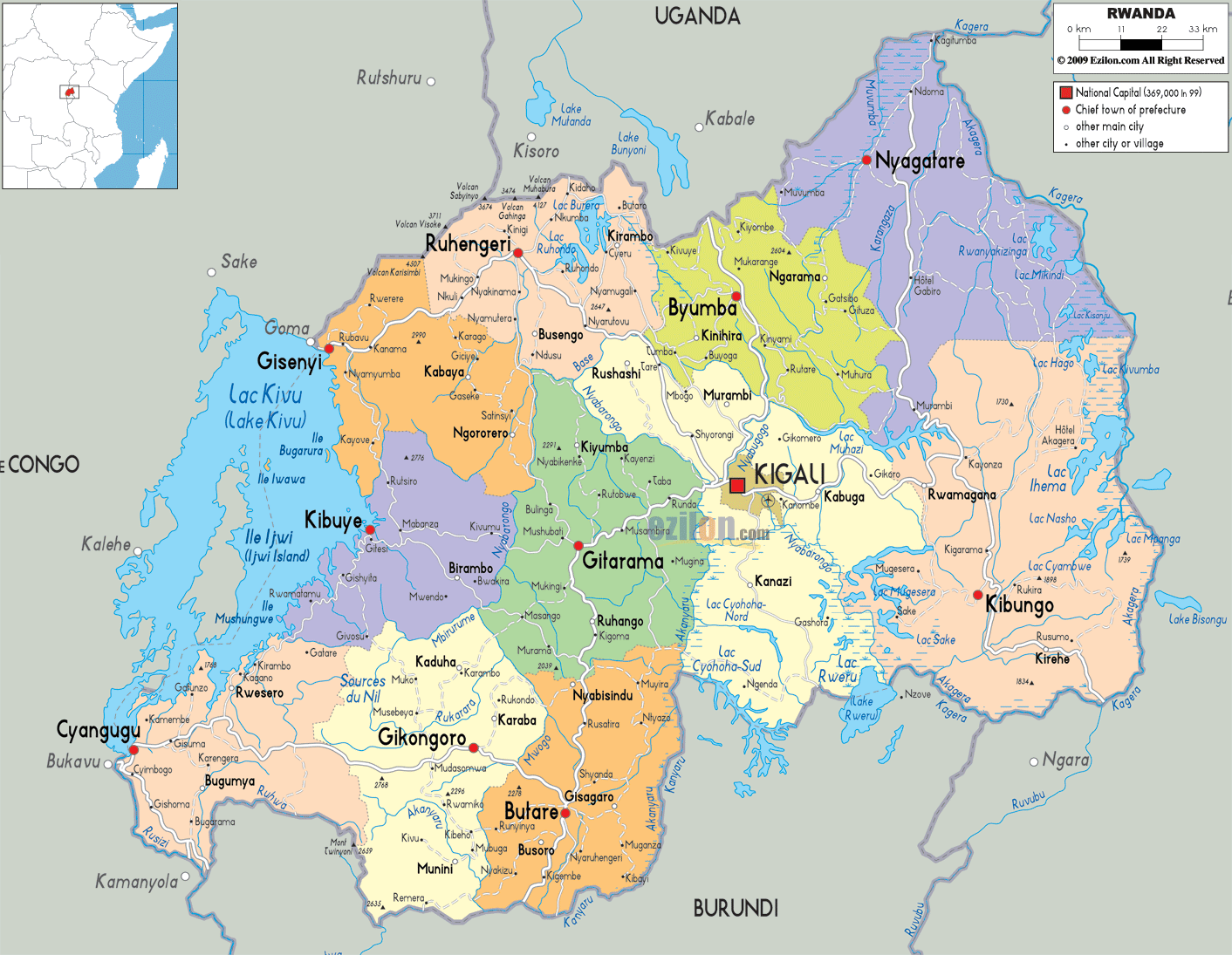
Description: Detailed large political map of Rwanda showing names of capital cities, towns, states, provinces and boundaries with neighbouring countries.
 Rwanda
is a country that lies in the east-central Africa. This
small landlocked nation is surrounded by Tanzania,
Congo, Burundi and Uganda. Rwanda is one of the highly
populated nations in Africa and its population is about
10.1 million. Most of the people in the country depend
on agriculture for their livelihood. Rwanda is the first
country in the world to have a national legislature that
consists of mainly women. Rwanda is a small country and
it is about half the size of Scotland. It is located a
few degrees on the south of the equator.
Rwanda
is a country that lies in the east-central Africa. This
small landlocked nation is surrounded by Tanzania,
Congo, Burundi and Uganda. Rwanda is one of the highly
populated nations in Africa and its population is about
10.1 million. Most of the people in the country depend
on agriculture for their livelihood. Rwanda is the first
country in the world to have a national legislature that
consists of mainly women. Rwanda is a small country and
it is about half the size of Scotland. It is located a
few degrees on the south of the equator.
The people from Rwanda are called Rwandan.

Physical Map of Rwanda
Physical map and map image of Rwanda.

Road Map of Rwanda
Road map and map image of Rwanda.

Regional Directory of United States of America
Information and guide about United States of America and websites with American topics.

Regional Directory of Europe
Information and guide about Europe and websites with European topics.

Regional Directory of Australia
Information and guide about Australia and websites with Australian topics.