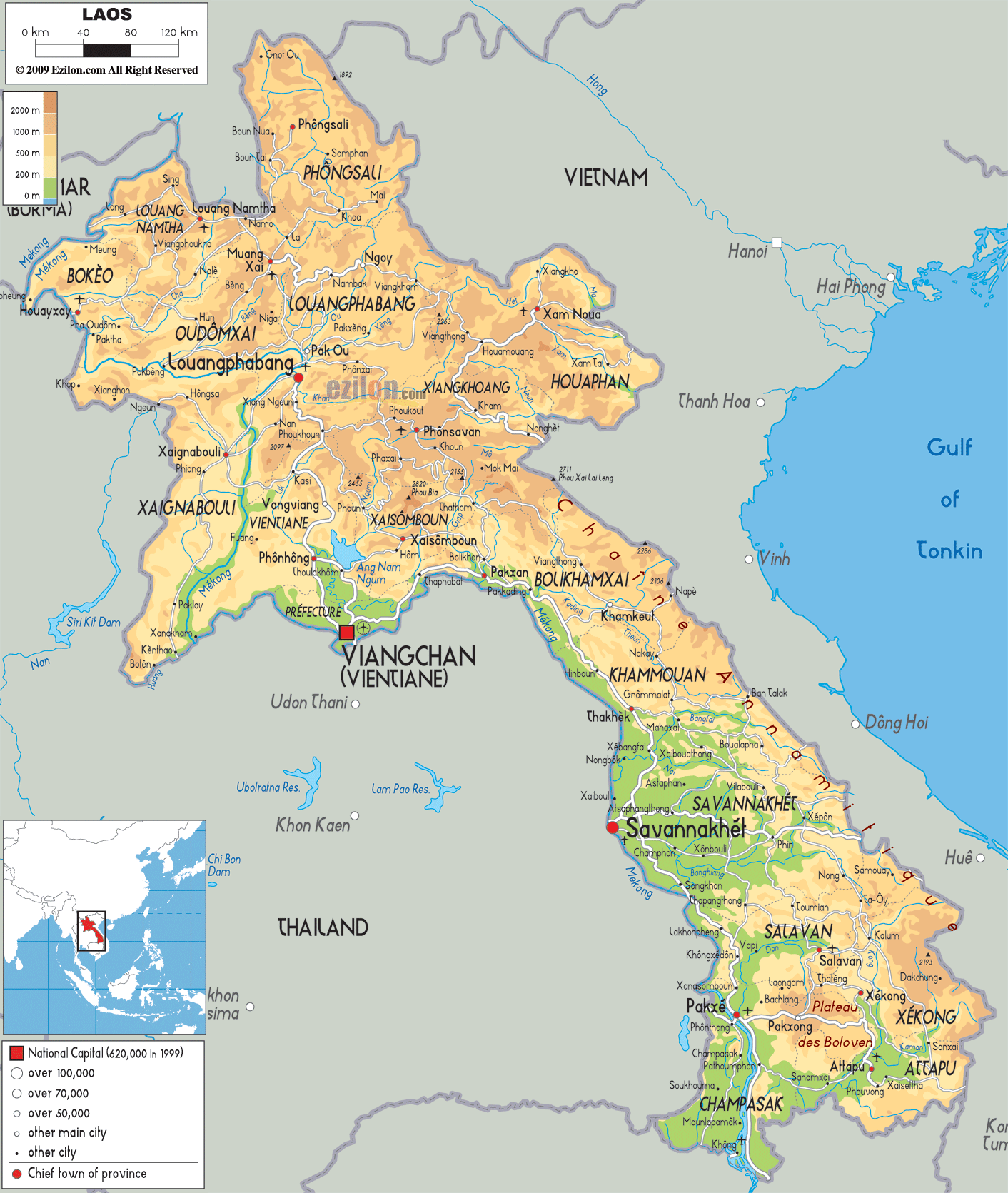
Description: The Physical Map of Laos showing major geographical features like elevations, mountain ranges, deserts, seas, lakes, plateaus, peninsulas, rivers, plains, landforms and other topographic features.
 Laos
also officially called the Lao People's Democratic
Republic. It is situated in Southeast Asia and
surrounded by land. It does not have coastal
boundary.236,800 square kilometres is the total area of
Laos. It shares its boundary with Cambodia to the south,
Vietnam to the east, Thailand to the west and Burma and
China to the northwest.
Laos
also officially called the Lao People's Democratic
Republic. It is situated in Southeast Asia and
surrounded by land. It does not have coastal
boundary.236,800 square kilometres is the total area of
Laos. It shares its boundary with Cambodia to the south,
Vietnam to the east, Thailand to the west and Burma and
China to the northwest.
PhouBia at 2,818 metres is the highest mountain of the
country. The landscape of Laos is densely forested and
has many mountain ranges with plateaus and plains. Its
western boundary with Thailand is formed by the Mekong
River. Annamite Mountain Range in the east forms the
border with Vietnam.
Laos belongs to the region which is known as Golden
Triangle for its opium poppy growing capacity. Laos is
considered to be a part of the three areas i.e. south,
north and central. Hydropower, tin, timber, gypsum,
gemstones and gold are the natural resources of Laos.

Political Map of Laos
Political map and map image of Laos.

Road Map of Laos
Road map and map image of Laos.

Regional Directory of United States of America
Information and guide about United States of America and websites with American topics.

Regional Directory of Europe
Information and guide about Europe and websites with European topics.

Regional Directory of Australia
Information and guide about Australia and websites with Australian topics.