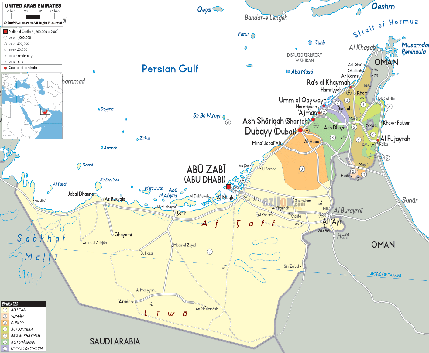
Description: Detailed large political map of United Arab of Emirates showing names of capital city, towns, states, provinces and boundaries with neighbouring countries.
 The
United Arab Emirates (or the U.A.E as it is commonly
referred to as) is located in the Southwest Asia and it
is located in the Arabian Peninsula. It has Saudi Arabia
and Oman as its neighbors. There are seven emirates or
states in the United Arab Emirates and they are
Fujairah, Ras al-Khaimah, Umm al-Quwain, Ajman, Sharjah,
Dubai and Abu Dhabi. Abu Dhabi is the capital city of
the country and it is also the second largest city of
the U.A.E. Abu Dhabi is considered to be the industrial,
cultural and political center of the country.
The
United Arab Emirates (or the U.A.E as it is commonly
referred to as) is located in the Southwest Asia and it
is located in the Arabian Peninsula. It has Saudi Arabia
and Oman as its neighbors. There are seven emirates or
states in the United Arab Emirates and they are
Fujairah, Ras al-Khaimah, Umm al-Quwain, Ajman, Sharjah,
Dubai and Abu Dhabi. Abu Dhabi is the capital city of
the country and it is also the second largest city of
the U.A.E. Abu Dhabi is considered to be the industrial,
cultural and political center of the country.

Physical Map of United Arab of Emirates
Physical map and map image of United Arab of Emirates.

Road Map of United Arab of Emirates
Road map and map image of United Arab of Emirates.

Regional Directory of United States of America
Information and guide about United States of America and websites with American topics.

Regional Directory of Europe
Information and guide about Europe and websites with European topics.

Regional Directory of Australia
Information and guide about Australia and websites with Australian topics.