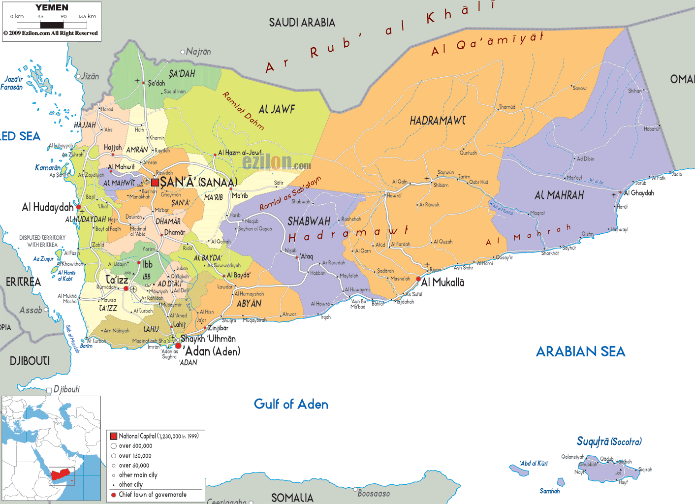
Description: Detailed large political map of Yemen showing names of capital city, towns, states, provinces and boundaries with neighbouring countries.
 The
Republic of Yemen is located in the Southeast Asia and
it is a nation that lies on the Arabian Peninsula. There
are about twenty-three million people living on its
land. Yemen is bordered by the Gulf of Aden and the
Arabian Sea on its south, Oman on its east, the Red Sea
is located on its west and Saudi Arabia is located on
its north. The size of the country is about 530,000
square kilometers and there are about two hundred
islands in this nation.
The
Republic of Yemen is located in the Southeast Asia and
it is a nation that lies on the Arabian Peninsula. There
are about twenty-three million people living on its
land. Yemen is bordered by the Gulf of Aden and the
Arabian Sea on its south, Oman on its east, the Red Sea
is located on its west and Saudi Arabia is located on
its north. The size of the country is about 530,000
square kilometers and there are about two hundred
islands in this nation.
The geography of the nation has been divided in to four
regions and they are the Rub al Khali, the eastern
highlands, the coastal plains and the western highlands.
Most of the people living in Yemen are followers of
Islam and as such, this is the main religion of the
country. However, there are some people who are
Christians, Jews and Hindu. There are about twenty-one
million people in this nation and about 45% of the total
population is less than fifteen years of age.

Physical Map of Yemen
Physical map and map image of Yemen.

Road Map of Yemen
Road map and map image of Yemen.

Regional Directory of United States of America
Information and guide about United States of America and websites with American topics.

Regional Directory of Europe
Information and guide about Europe and websites with European topics.

Regional Directory of Australia
Information and guide about Australia and websites with Australian topics.