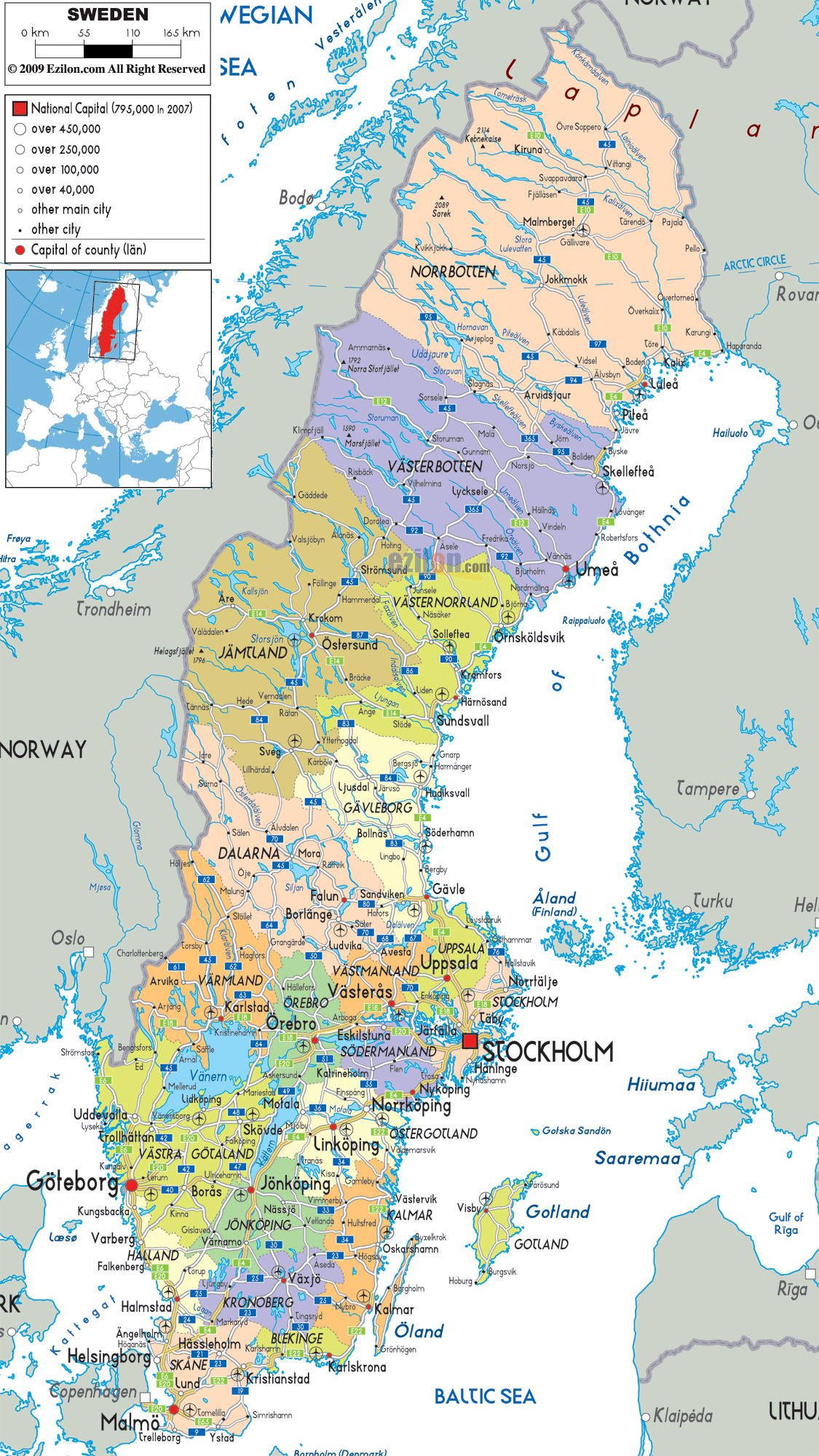
Description: Detailed large political map of Sweden showing names of capital cities, towns, states, provinces and boundaries with neighbouring countries.
 Sweden
is lies in the Scandinavian Peninsula and it is a Nordic
nation. Situated in the northern Europe, Sweden is
surrounded by Norway on its west and it shares a border
with Finland on the northeast.
Sweden
is lies in the Scandinavian Peninsula and it is a Nordic
nation. Situated in the northern Europe, Sweden is
surrounded by Norway on its west and it shares a border
with Finland on the northeast.
The Oresund Bridge links this nation with Denmark. Swedish is the chief language that is spoken in the country and the language is similar to Norwegian and Danish. Stockholm is the capital city of Sweden and it is also the largest city in the country.
The other largest cities are Malmo and Gothenburg. The population in this country is low and it has about 9.2 million people living on its land. More than 4/5th of the population lives in the urban areas in the country.
Sweden experiences a temperate climate and it has four seasons in a year. The economy of Sweden is basically an economy that is export–based. The agricultural sector in the country contributes to about 2 percent of the country’s GDP. Among the largest companies in Sweden, some of them are Ericsson, Volvo, Electrolux, etc.
The country is home to many recognized authors such as Harry Martinson, Astrid Lindgren, etc. The cuisine of the country is actually very simple and it includes potatoes, meat and fish.

Physical Map of Sweden
Physical map and map image of Sweden.

Road Map of Sweden
Road map and map image of Sweden.

Regional Directory of United States of America
Information and guide about United States of America and websites with American topics.

Regional Directory of Europe
Information and guide about Europe and websites with European topics.

Regional Directory of Australia
Information and guide about Australia and websites with Australian topics.