Description: The Physical Map of Marshall Islands showing major geographical features like elevations, mountain ranges, deserts, lakes, plateaus, peninsulas, rivers, plains, landforms and other topographic features.
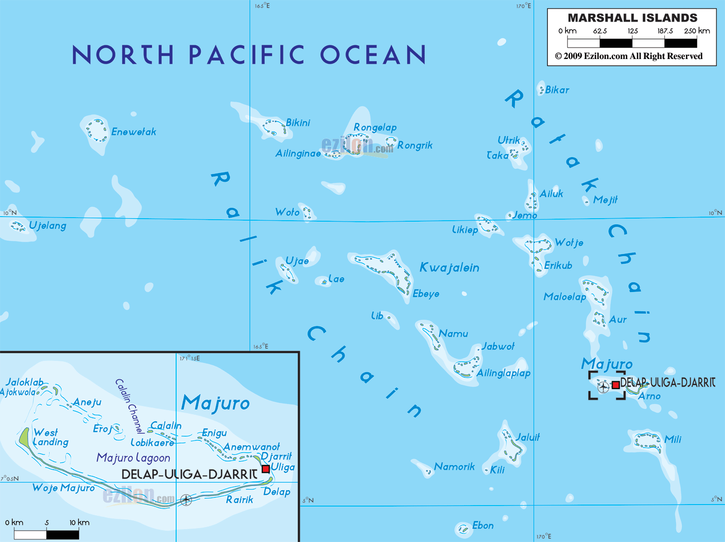
 The
Marshall Islands are a group located in the Oceania
region between north latitude 9 degrees and east
longitude 168 degrees. The group consists of five
independent islands and 29 atolls. They are lined up in
two parallel lines, the Ratak and the Ralik. The total
area taken up by the islands and atolls add up to 181.3
square kilometers, all of which is land. The total
coastline adds up to 370.4 kilometers. The country
claims a territorial sea till 12 nautical miles.
The
Marshall Islands are a group located in the Oceania
region between north latitude 9 degrees and east
longitude 168 degrees. The group consists of five
independent islands and 29 atolls. They are lined up in
two parallel lines, the Ratak and the Ralik. The total
area taken up by the islands and atolls add up to 181.3
square kilometers, all of which is land. The total
coastline adds up to 370.4 kilometers. The country
claims a territorial sea till 12 nautical miles.
The climate on the islands is particularly hot and
humid. There are cyclones and thypoons occasionally as
the country sits at the edge of the Typhoon Belt of the
North Pacific Ocean. The general height of the islands
is very low as it is mostly low lying coral limestones
and sandy beaches. The highest point on the group
measures in at 10 meters above sea level and has no
name.
The hot and humid climate with no rivers makes the land
absolutely unfertile. Only 11% percent of the entire
land is fertile and suitable for growing crops. The
rainy season starts in the month of May and goes on till
November. This is when a few creeks flood and run
through the lands.

Regional Directory of Australia
Information and guide about Australia and website listing.

Directory of the World
Information and guide about the World and website listing.

Regional Directory of United States of America
Information and guide about United States of America and websites with American topics.

Regional Directory of Europe
Information and guide about Europe and websites with European topics.

Regional Directory of Australia
Information and guide about Australia and websites with Australian topics.