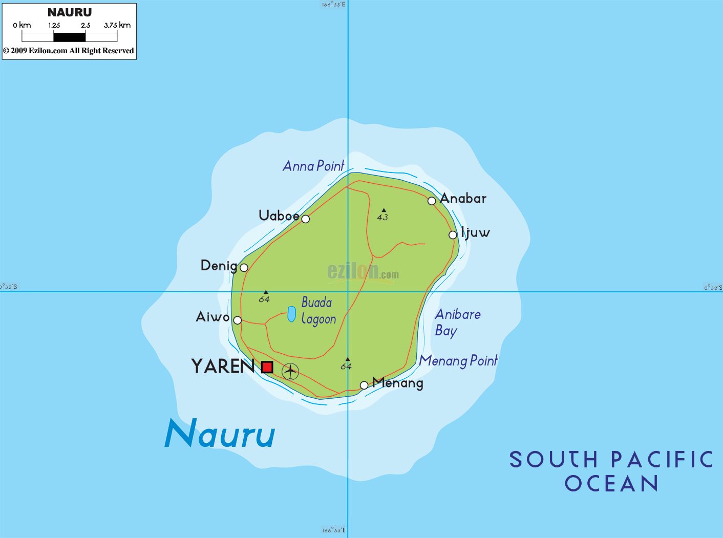
Description: The Physical Map of Nauru showing major geographical features like elevations, mountain ranges, deserts, lakes, plateaus, peninsulas, rivers, plains, landforms and other topographic features.
 Nauru
is a phosphate rock island country situated in the South
Pacific Ocean. The country lies between 0.32 degrees
south latitude and 165.5 degrees east longitude. The
group of islands is a mere 53 kilometers below the
equator. The country has a land area of 21 square
kilometers and a coastline which measures in at 30
kilometers in length. The island has a tropical type of
climate with rainfall during the month of November to
February.
Nauru
is a phosphate rock island country situated in the South
Pacific Ocean. The country lies between 0.32 degrees
south latitude and 165.5 degrees east longitude. The
group of islands is a mere 53 kilometers below the
equator. The country has a land area of 21 square
kilometers and a coastline which measures in at 30
kilometers in length. The island has a tropical type of
climate with rainfall during the month of November to
February.
The high Phosphate Plateau is located centrally in the
island and takes up most of the area. It is fertile and
above the surrounding coral reefs. The highest point on
the island is called Command Ridge as it rests at 61
meters above sea level at the edge of the plateau.
Being surrounded by coral reefs, the island has no
rivers, lakes or natural harbors. The lowest point
however falls to the mean sea level on the Pacific
Ocean. The islands is one of only two other phosphate
rock islands on Earth. The country claims a territorial
sea till 12 nautical miles from the shores. The island
was formed after the 4,300 meters high seamount was
eroded at the base by the waters of the ocean. This lead
to the formation of many small coral atolls and islands.

Regional Directory of Australia
Information and guide about Australia and website listing.

Directory of the World
Information and guide about the World and website listing.

Regional Directory of United States of America
Information and guide about United States of America and websites with American topics.

Regional Directory of Europe
Information and guide about Europe and websites with European topics.

Regional Directory of Australia
Information and guide about Australia and websites with Australian topics.