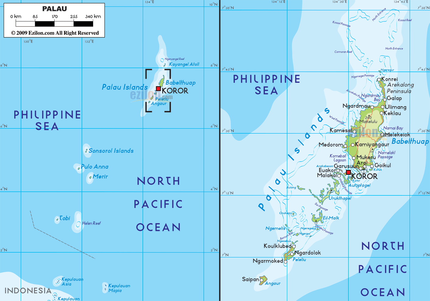
Description: The Physical Map of Palau showing major geographical features like elevations, islands, ocean, lakes, plateaus, peninsulas, rivers, plains, landforms and other topographic features.
 The
Republic of Palau is comprised of more than 250 small
islands and 8 principal ones. The islands constitute a
part of the Caroline Islands Chain and are located in
the North Pacific Ocean. The geographic coordinates read
as follows: 7.30 degrees north latitude and 134.3
degrees east longitude. The islands lie in the Oceania
region of Micronesia and cover an area of 459 square
kilometers all of which is land.
The
Republic of Palau is comprised of more than 250 small
islands and 8 principal ones. The islands constitute a
part of the Caroline Islands Chain and are located in
the North Pacific Ocean. The geographic coordinates read
as follows: 7.30 degrees north latitude and 134.3
degrees east longitude. The islands lie in the Oceania
region of Micronesia and cover an area of 459 square
kilometers all of which is land.
The combined coastlines measures up to be 1519
kilometers long. The combined territorial sea claimed
goes on till 3 nautical miles from the coast. The
climate is particularly tropical with a long wet season
from May to November.
The topography of the islands vary from high mountainous
ones to low lying coral atolls. The highest point lies
in the island called Babeldaob and is known as Mount
Ngerchelchauus. It is 242 meters high and the lowest
point rest at the mean sea level on the Pacific Ocean.
Due to no freshwater rivers or lakes being present most
of the land is infertile and only 2% of the entire land
mass is arable. The islands rest near the border of the
Pacific Typhoon Belt and are often struck by storms.

Regional Directory of Australia
Information and guide about Australia and website listing.

Directory of the World
Information and guide about the World and website listing.

Regional Directory of United States of America
Information and guide about United States of America and websites with American topics.

Regional Directory of Europe
Information and guide about Europe and websites with European topics.

Regional Directory of Australia
Information and guide about Australia and websites with Australian topics.