Description: The Physical Map of Tonga showing major geographical features like elevations, islands, ocean, lakes, plateaus, peninsulas, rivers, plains, landforms and other topographic features.
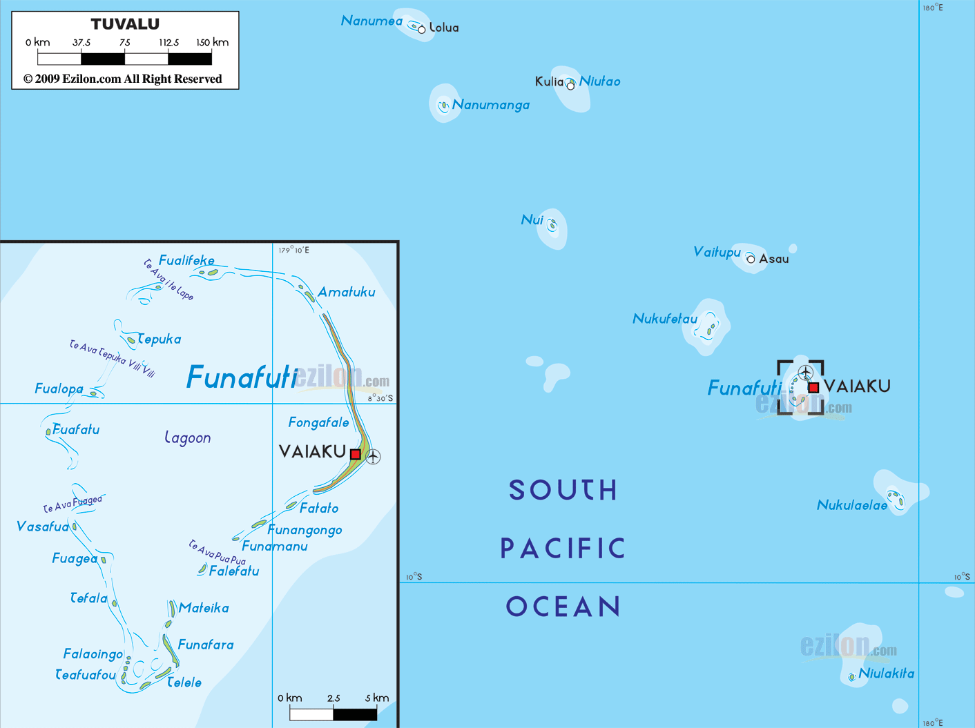
 Tuvalu
is an archipelago formerly called the Ellice Islands,
situated in the West Pacific Ocean. The group has 6
coral atolls and 3 reef islands. The total land area
covered by the country is a mere 26 square kilometers.
It is located in the sub region of Oceania. The country
lies between south latitude 5.41 degrees and east
longitude 179.5 degrees.
Tuvalu
is an archipelago formerly called the Ellice Islands,
situated in the West Pacific Ocean. The group has 6
coral atolls and 3 reef islands. The total land area
covered by the country is a mere 26 square kilometers.
It is located in the sub region of Oceania. The country
lies between south latitude 5.41 degrees and east
longitude 179.5 degrees.
The country has no rivers or lakes as all of its area is
covered by land. The country has a coastline of 24
kilometers with the ocean. Most of the country is low
lying and the highest peak is just 4.6 meters above sea
level. The lowest point rests at mean sea level on the
Pacific Ocean.
The islands have a tropical type of climate which is
frequently by trade winds. The average yearly rainfall
is about 140 inches. The islands sit on the north end of
the cyclone belt and have often been devastated by the
strong winds. The islands have many lagoons, the largest
of which is located at Funafuti. There are no fresh
water lakes or rivers in the country. Most of the
country is covered with coconut plantations which
replaced the earlier forests. Located on the Pacific
Tectonic Plate the country also experiences earthquakes.

Regional Directory of Australia
Information and guide about Australia and website listing.

Directory of the World
Information and guide about the World and website listing.

Regional Directory of United States of America
Information and guide about United States of America and websites with American topics.

Regional Directory of Europe
Information and guide about Europe and websites with European topics.

Regional Directory of Australia
Information and guide about Australia and websites with Australian topics.