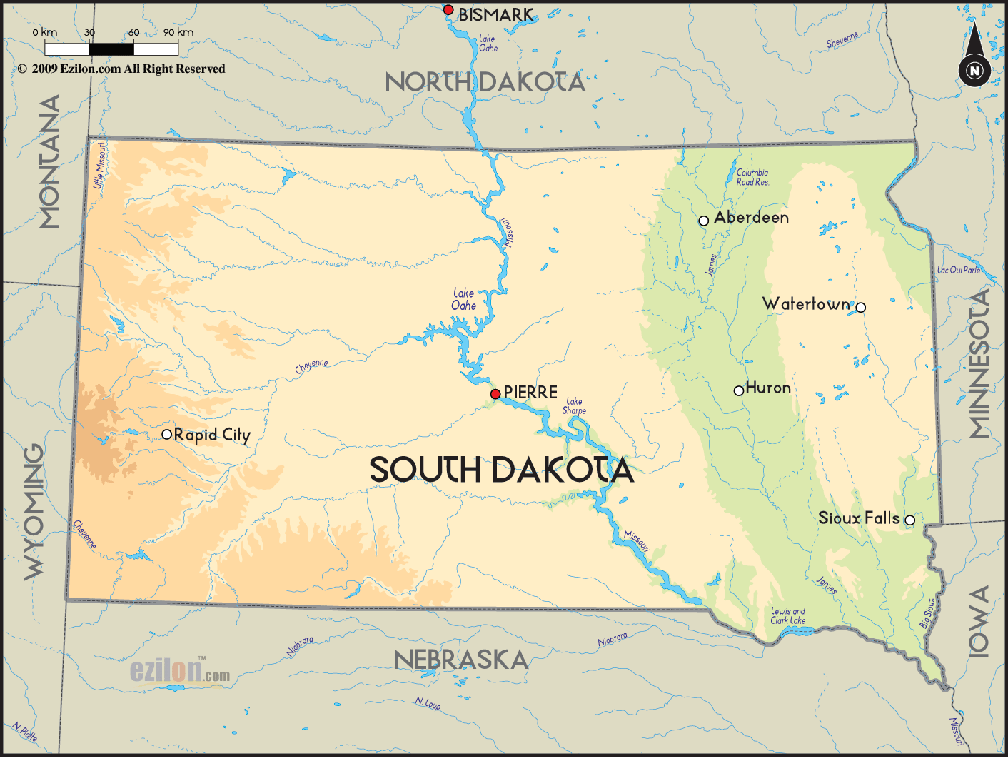
 South
Dakota is a state in the Midwestern part of the country
of United States. It is the southern half of the Dakota
Territory and the capital of this state is Pierre. The
largest city in South Dakota is Sioux Falls. During the
year 2008 census, it was found that the state has a
population of about 804,194 people. South
Dakota is a state in the Midwestern part of the country
of United States. It is the southern half of the Dakota
Territory and the capital of this state is Pierre. The
largest city in South Dakota is Sioux Falls. During the
year 2008 census, it was found that the state has a
population of about 804,194 people.
South Dakota has
been divided in to two by the Missouri River. On the
western part of the state, ranching is the main activity
and on the eastern part of South Dakota, agriculture is
the chief activity because the land has fertile soil
that is fit for growing crops.
The longest and the largest River in this state is the
Missouri River. The other main rivers in South Dakota
consist of White, Big Sioux, James and Cheyenne Rivers.
The eastern part of this state has quite a few natural
lakes and majority of these were created because of
periods of glaciations.
There are two national parks in
this state and both these national parks are situated on
the southwestern part of South Dakota.
The majority of
the people living in this state are whites. Some of the
large ethnic groups here are the English, Native
Americans, Germans, Irish and Norwegians.
|