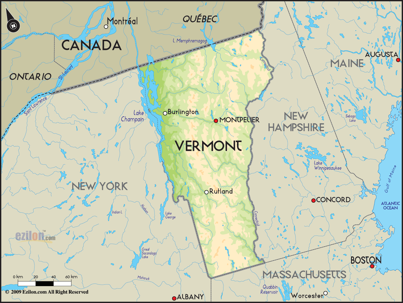
 Vermont
is a state in the United States that lies in the New
England region and it has a land area of about 24,000
square kilometers. In terms of its land area, this state
is considered to be the 43rd largest state in the
country. Vermont
is a state in the United States that lies in the New
England region and it has a land area of about 24,000
square kilometers. In terms of its land area, this state
is considered to be the 43rd largest state in the
country.
The number of people living in Vermont is about
621,270 people and it is considered to be the second
least populous state in the United States. It is the
only New England State that does not have a coastline
along the Atlantic Ocean.
Lake Champlain is quite
well-known in this state and this lake takes up about
half of the state’s western border.
On the north of Vermont there is Quebec (Canada), on its
west there is New York, on its east there is New
Hampshire and on its south there is Massachusetts.
Vermont is the largest producer of maple syrup in the
country. The capital if this state is Montpelier and
Burlington is the metropolitan area as well as the
largest city in Vermont.
About fifty-one percent of the
population in this state consists of female and the
remaining percentage consists of male. Vermont is a
state with the second highest population of whites. |