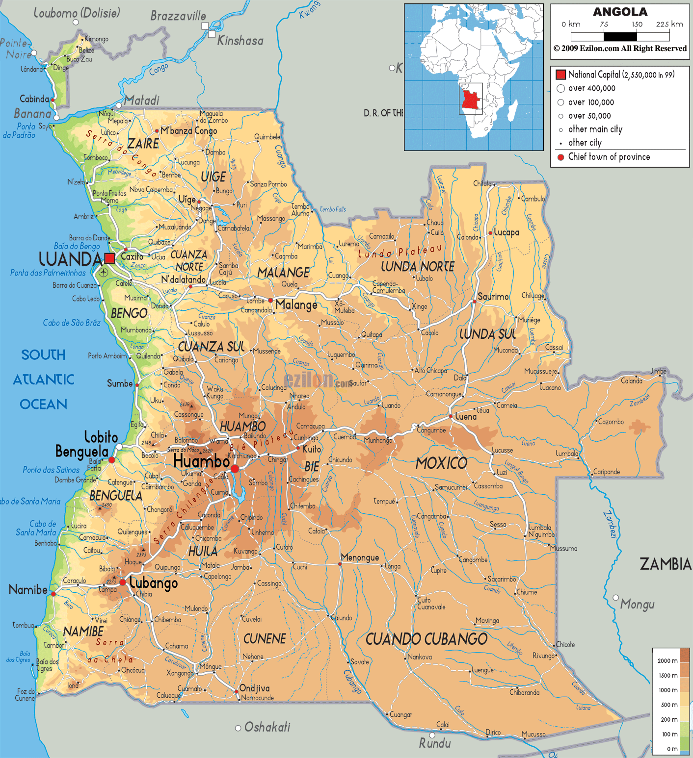
Detailed Physical map of Angola showing plateaus, rivers, elevations and other topographic features. Angola shares its borders with Namibia, Zambia, the Democratic Republic of the Congo and the Republic of the Congo.
This map of Angola with mountains, hills, lakes, rivers and other terrains is already large enough to read directly on your desktop. To see a full-screen zoom view on a phone or tablet, tap the map image (or tap the Zoom Map label above the image). Scan by shading provinces in various colored blocks, with Angola's mountains, hills, lakes and rivers in bold.
 Angola
is a country situated on the western Atlantic coast of
the South African continent. The country falls between
south latitude 12.30 degrees and east longitude 18.30
degrees. The country covers an area of 1246700 square
kilometres. The country borders the South Atlantic
Ocean. The coastline measure up to be 100 kilometres
long.
Angola
is a country situated on the western Atlantic coast of
the South African continent. The country falls between
south latitude 12.30 degrees and east longitude 18.30
degrees. The country covers an area of 1246700 square
kilometres. The country borders the South Atlantic
Ocean. The coastline measure up to be 100 kilometres
long.
The country can easily be divided into 4 ecological
regions: The coastal lowlands, High plateaus, Hills and
mountains and the rain forest. The coastal lowlands are
relatively flat and low lying lands with very few
terraces. The high plateau is an area with an average
height of 1500 metres and is an arable area with lots of
rolling hills and plains.
The Cuanza River separates the mountains into two parts
towards the north and south respectively. The northern
parts near the coast rise gradually and have an average
height of 1500 metres whereas the southern part of this
region rises abruptly and even has the highest peak
within it known as Mount Moco which is 2620 metres above
sea level. The furthest range to the south is called the
Serra de Chella.
The two major rivers flowing through the country are the
Zambezi and Congo. The latter is the longest river in
the country as it flows for 4344 metres.

Political Map of Angola
Political map and map image of Angola.

Road Map of Angola
Road map and map image of Angola.

Regional Directory of United States of America
Information and guide about United States of America and websites with American topics.

Regional Directory of Europe
Information and guide about Europe and websites with European topics.

Regional Directory of Australia
Information and guide about Australia and websites with Australian topics.
