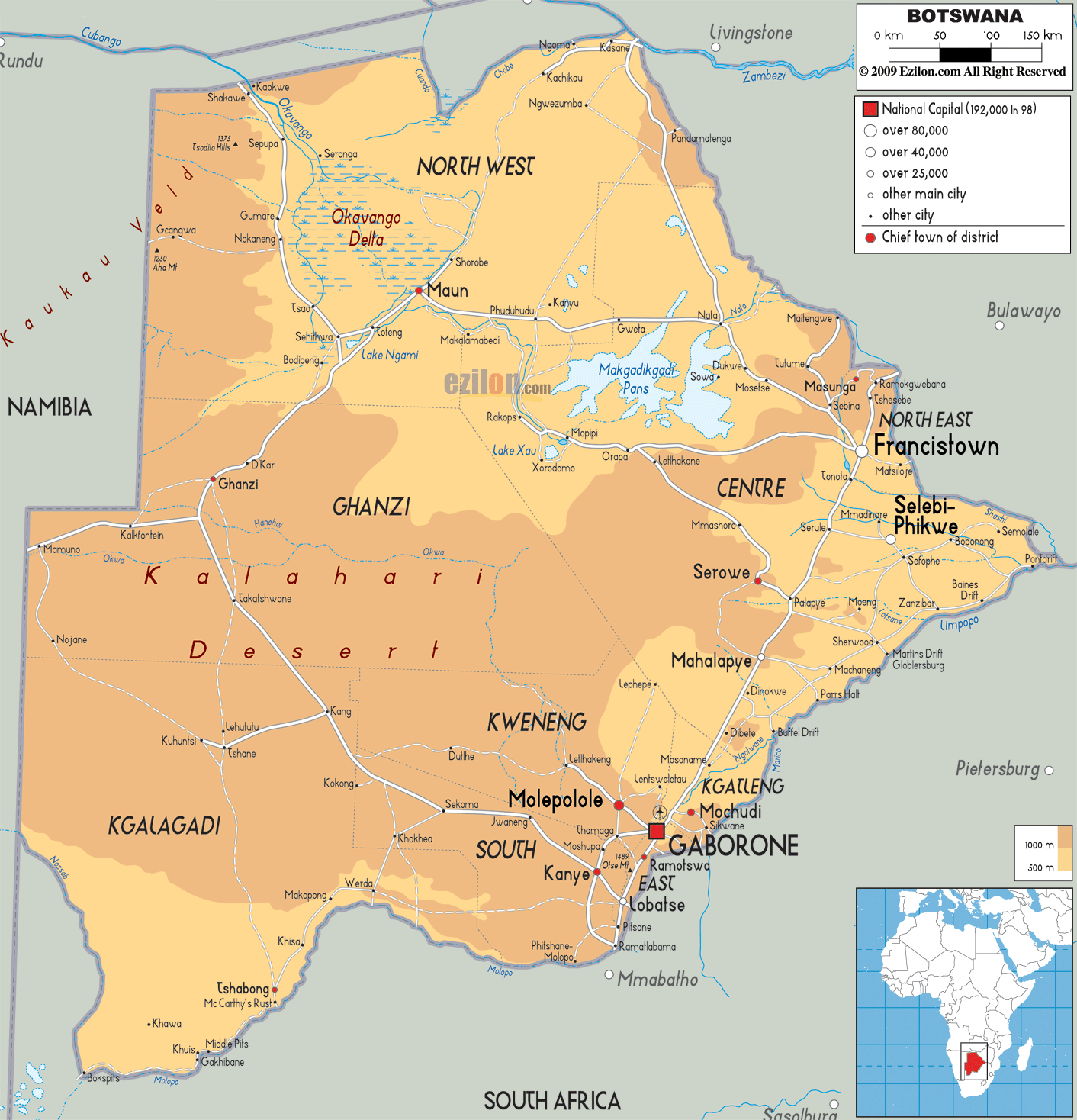
Detailed Physical map of Botswana showing deserts, wetlands, elevations and other topographic features. Landlocked Botswana shares its borders with Namibia, Zambia, Zimbabwe and South Africa.
This map of Botswana with mountains, hills, lakes, rivers and other terrains is already large enough to read directly on your desktop. To see a full-screen zoom view on a phone or tablet, tap the map image (or tap the Zoom Map label above the image). Scan by shading districts in various colored blocks, with Botswana's mountains, hills, lakes and rivers in bold.
 Botswana
is a country landlocked in the northern part of South
Africa. The country covers an area of 600370 square
kilometres. Only 585000 square kilometres of it is land.
The land in the country is mostly flat with alight
undulations at the tableland and hilly regions.
Botswana
is a country landlocked in the northern part of South
Africa. The country covers an area of 600370 square
kilometres. Only 585000 square kilometres of it is land.
The land in the country is mostly flat with alight
undulations at the tableland and hilly regions.
Central Botswana is dominated by the Kalahari Desert. The Okavango Delta is towards the northwest and is one of the largest deltas in the world. The north central area comprises the Makgadikgadi Salt Pans.
The lowest point in the country is located under the meeting point of the Shashe and Limpopo Rivers at 513 metres. The Monalanong Hill is the highest natural peak in the country standing tall at 1494 metres above sea level.
The four main rivers form basins within the country: Limpopo Basin to the east, Okavango Delta to the north central, Chobe river in the Zambezi Basin and the Orange river basin to the south. The Orange river flow for the most distance across the country.
The Okavango, Chobe, Limpopo and Boteti are the only
perennial rivers as all the others dry out during the
dry season. The country is dominated by an arid climate
due to the super short rainy season.

Political Map of Botswana
Political map and map image of Botswana.

Road Map of Botswana
Road map and map image of Botswana.

Regional Directory of United States of America
Information and guide about United States of America and websites with American topics.

Regional Directory of Europe
Information and guide about Europe and websites with European topics.

Regional Directory of Australia
Information and guide about Australia and websites with Australian topics.