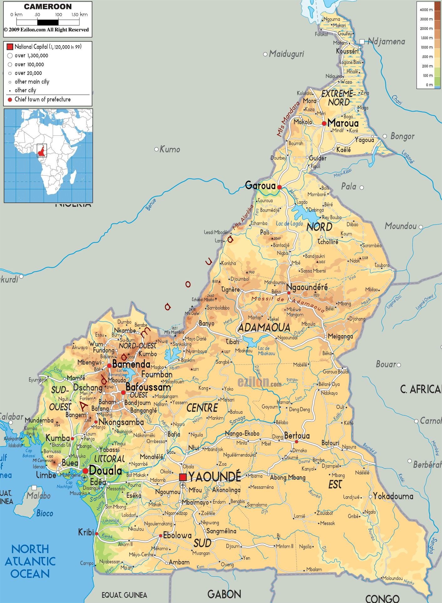
Detailed Physical map of Cameroon showing Mount Cameroon, rainforest, coastline and other topographic features. Cameroon shares borders with Nigeria, Chad, the Central Africa Republic, the Republic of the Congo, Gabon and Equatorial Guinea.
This map of Cameroon with mountains, hills, lakes, rivers and other terrains is already large enough to read directly on your desktop. To see a full-screen zoom view on a phone or tablet, tap the map image (or tap the Zoom Map label above the image). Scan by shading regions in various colored blocks, with Cameroon's mountains, hills, lakes and rivers in bold.
 The
country of Cameroon is situated in West and Central
Africa. It is bordered by the Bight of Biafra to the
southwest. The total land area covered by the country
measures up to be 181252 square miles with 2317 miles of
additional water bodies and it is the 53rd largest
country in the world.
The
country of Cameroon is situated in West and Central
Africa. It is bordered by the Bight of Biafra to the
southwest. The total land area covered by the country
measures up to be 181252 square miles with 2317 miles of
additional water bodies and it is the 53rd largest
country in the world.
The country showcases most of the Africa’s climatic
regions and is often called mini Africa. The country has
deserts, plains, rain forests, mountains, hills and
ocean coastlines.
The plains of the country stretch inwards from the Gulf
of Guinea and go all the way to the plateau. The plains
are well forested and also have the African mangroves
along with the Douala. The southern plateau, which rises
from the coastlines, has a typical rain forest type of
climate.
The western end of the country is marked with trees,
rivers and mountains which go all the way to Lake Chad
which is the southernmost tip of the country. Going
north from south, the land gradually rises and becomes
undulating. This area is called the Adamawa highlands.
The area between the Adamawa and Lake Chad is occupied
by the Savanna Plains.
Mount Cameroon is the highest peak in the country,
measuring in at 4095 metres whereas the lowest point is
on the Atlantic Ocean. The Sanaga River is the longest
in the country as it flows for 920 kilometres.

Political Map of Cameroon
Political map and map image of Cameroon.

Road Map of Cameroon
Road map and map image of Cameroon.

Regional Directory of United States of America
Information and guide about United States of America and websites with American topics.

Regional Directory of Europe
Information and guide about Europe and websites with European topics.

Regional Directory of Australia
Information and guide about Australia and websites with Australian topics.
