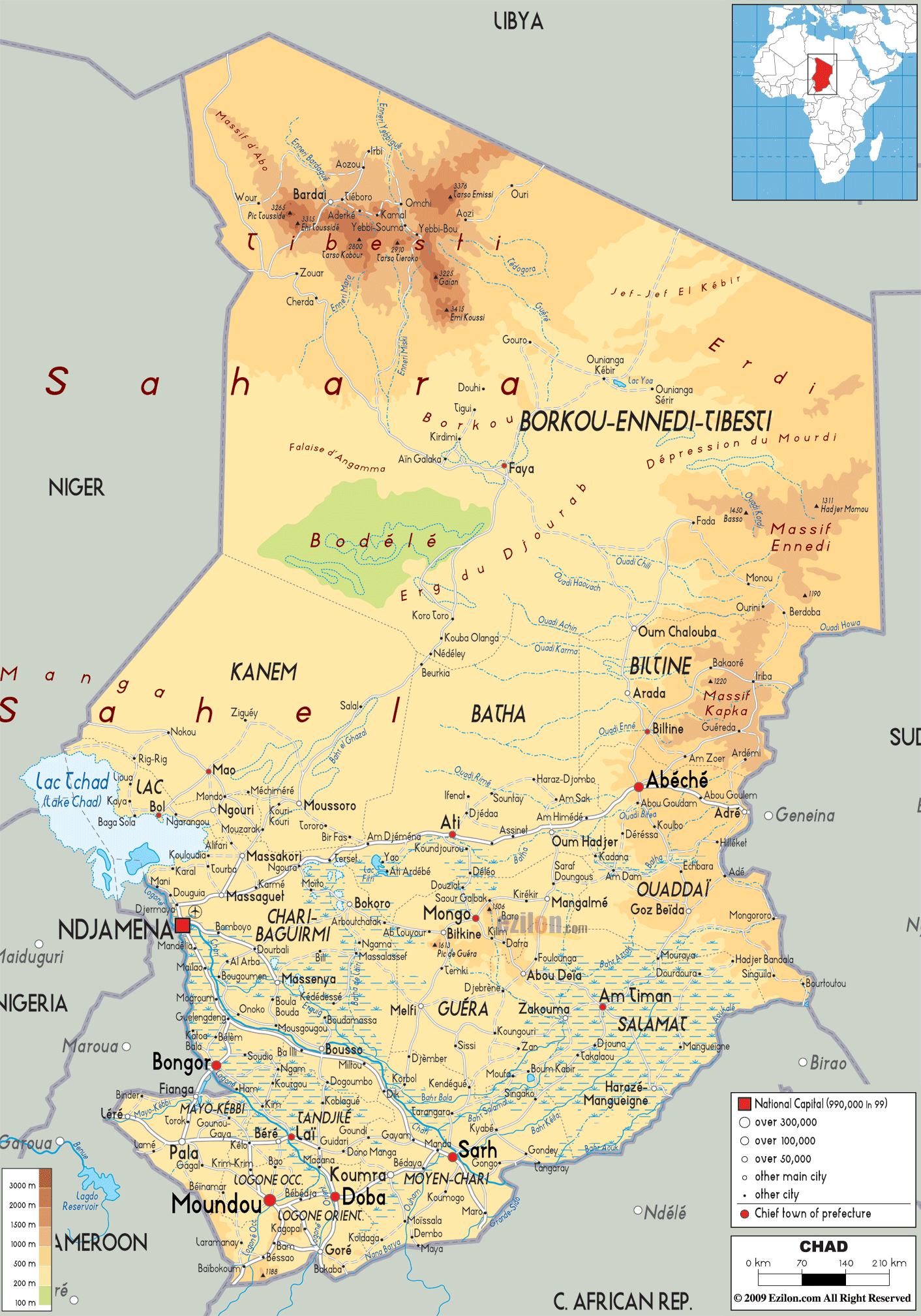
Description: The Physical Map of Chad showing major geographical features like elevations, mountain ranges, deserts, lakes, plateaus, peninsulas, rivers, plains, landforms and other topographic features.
 Out
of the 48 landlocked countries in the world Chad is one
situated in the African continent. Located in central
Africa, the country measures in at 1,284000 square
kilometres. The country can be separated into 4
ecological regions. The far north part of the country is
dominated by a part of the Sahara Desert.
Out
of the 48 landlocked countries in the world Chad is one
situated in the African continent. Located in central
Africa, the country measures in at 1,284000 square
kilometres. The country can be separated into 4
ecological regions. The far north part of the country is
dominated by a part of the Sahara Desert.
The Sahelian zone in the centre is a well watered and green area. To the south the area is known as the Sudanian zone. This zone is the one with the most number of forests. The south-western area is called the Guinea zone and has mountains and hills all around.
Most of the country’s land is flat but ir gradually
rises to the east and north of Lake Chad. The highest
natural peak in the country is called Emi Koussi which
measures up to be approximately 3100 metres.
The mount is located in the Tibesti Mountain Range to
the northern side of the country. The Ouaddai highlands
and the Ennedi Plateau rise towards the west of Lake
Chad.
Lake Chad is the most important the lake covers 1350
square kilometres and is the second largest lake in the
continent. The Logone and Chari are the two main rivers
in the country.

Political Map of Chad
Political map and map image of Chad.

Road Map of Chad
Road map and map image of Chad.

Regional Directory of United States of America
Information and guide about United States of America and websites with American topics.

Regional Directory of Europe
Information and guide about Europe and websites with European topics.

Regional Directory of Australia
Information and guide about Australia and websites with Australian topics.