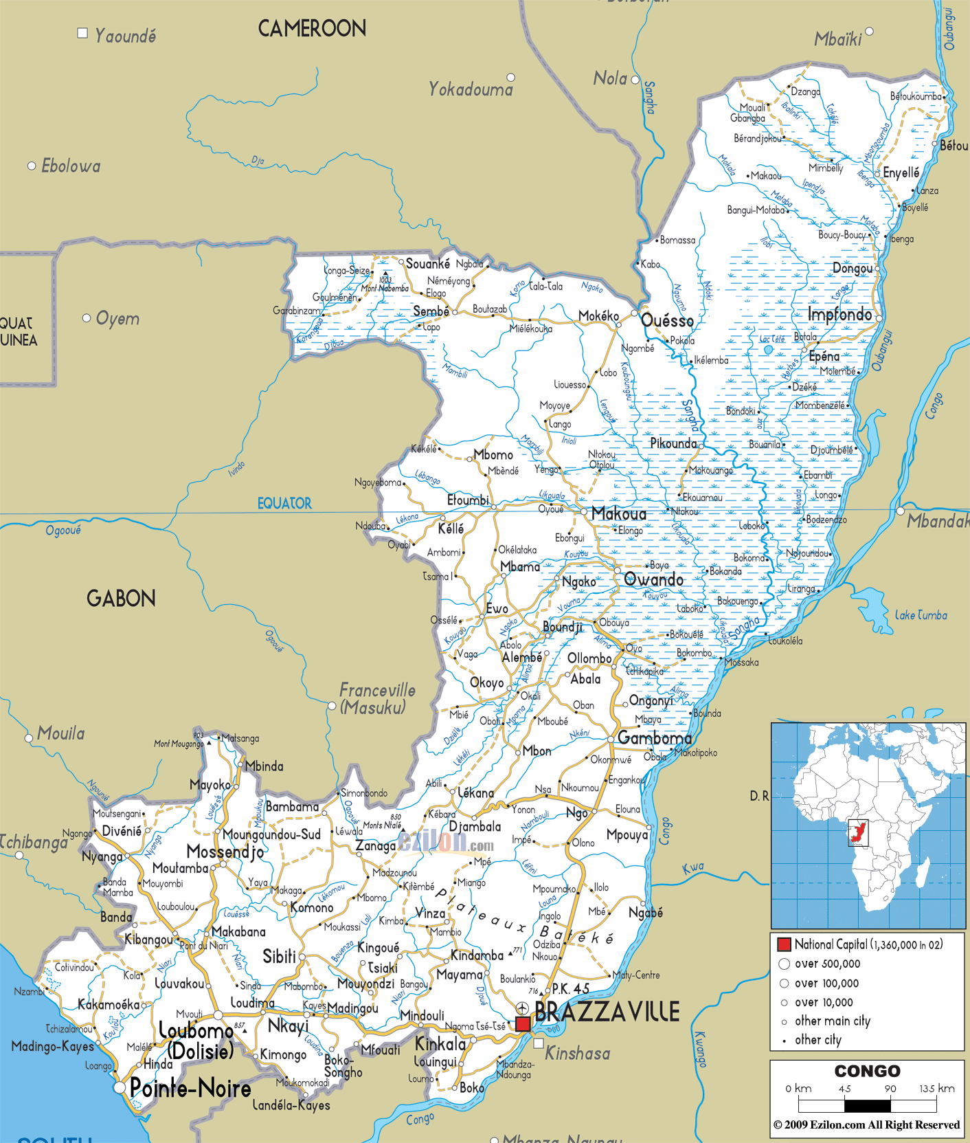
Description: Detailed clear large road map of Congo with road routes from cities to towns, road intersections to provinces and perfectures.
This map of Congo with highways, expressways, and roads is already large enough to read directly on your desktop. To see a full-screen zoom view on a phone or tablet, tap the map image (or tap the Zoom Map label above the image). Scan by shading departments in various colored blocks, with Congo's highways and expressways in bold.
 Detailed map of Congo with Road Map of Congo with Highways and Expressways etc. Congo shares its borders with Gabon, Cameroon, the Central African Republic, the Democratic Republic of the Congo and Angola (via the Cabinda exclave).
Situated
on the West coast of Central Africa, with Brazzaville as
its capital, Congo’s borders touch those of the Central
African Republic, the Democratic Republic of Congo,
Cameroon and Gabon. The official language is French but
most of the population speaks Lingala, Munukutuba and
Kikongo, while English is not spoken at all.
The coastal area looks out onto the Atlantic Ocean with lagoons scattered throughout its narrow sandy plain and the backdrop of the Mayombe Mountains. There are many swampy areas in this region with grassland and thick forests; here one can only travel around by boat up and down the many tributaries of the River Congo.
The people from Congo are called Congolese.

Physical Map of Congo
Physical map and map image of Congo.

Political Map of Congo
Political map and map image of Congo.

Regional Directory of United States of America
Information and guide about United States of America and websites with American topics.

Regional Directory of Europe
Information and guide about Europe and websites with European topics.

Regional Directory of Australia
Information and guide about Australia and websites with Australian topics.
