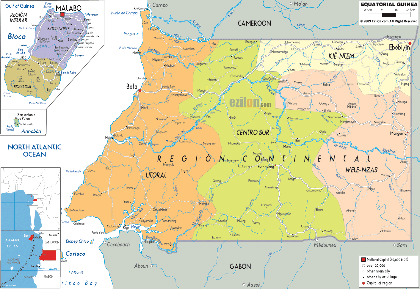
This map of Equatorial Guinea with cities, provinces, and towns is already large enough to read directly on your desktop. To see a full-screen zoom view on a phone or tablet, tap the map image (or tap the Zoom Map label above the image). Scan by shading provinces in various colored blocks, with Equatorial Guinea's cities and towns in bold.
 Equatorial
Guinea lies in the West Coast of Central Africa on the
Gulf of Guinea and the border with Cameroon and Gabon.
Malabo is its capital and the official languages spoken
are Spanish and French, although other African dialects
are spoken, such as Fang and Bubi.
Equatorial
Guinea lies in the West Coast of Central Africa on the
Gulf of Guinea and the border with Cameroon and Gabon.
Malabo is its capital and the official languages spoken
are Spanish and French, although other African dialects
are spoken, such as Fang and Bubi.
The island of Bioko and the small islands of Great Elobey, Small Elobey, Annobón and Corisco are also part of Equatorial Guinea. On the island of Bioko there are some magnificent beaches with the backdrop of two main peaks rising in the south. On the mainland there is much forestland with some snow-capped volcanoes and mountain areas as well as costal plains with lush vegetation and magnificent scenery.
The people from the Equatorial Guinea are called
Equatorial Guineans.

Physical Map of Equatorial Guinea
Physical map and map image of Equatorial Guinea.

Road Map of Equatorial Guinea
Road map and map image of Equatorial Guinea.

Regional Directory of United States of America
Information and guide about United States of America and websites with American topics.

Regional Directory of Europe
Information and guide about Europe and websites with European topics.

Regional Directory of Australia
Information and guide about Australia and websites with Australian topics.