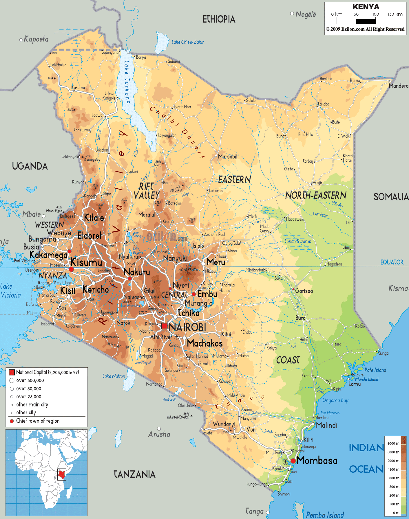
Description: The Physical Map of Kenya showing major geographical features like elevations, mountain ranges, deserts, Ocean, lakes, plateaus, peninsulas, rivers, plains, landforms and other topographic features.
This map of Kenya with mountains, hills, lakes, rivers and other terrains is already large enough to read directly on your desktop. To see a full-screen zoom view on a phone or tablet, tap the map image (or tap the Zoom Map label above the image). Scan by shading counties in various colored blocks, with Kenya's mountains, hills, lakes and rivers in bold.
 Detailed Physical map of Kenya showing the Great Rift Valley, Mount Kenya Highlands, coastline and other topographic features. Kenya shares borders with Ethiopia, Somalia, Tanzania and Uganda. The country is bordered by the Indian Ocean
to the southeast and the coastline is 536 kilometers
long. The country claims a territorial sea till 12
nautical miles from the shores. The total area covered
by the country is 580367 square kilometers of which
569140 square kilometers in land and 11227 square
kilometers is water.
Detailed Physical map of Kenya showing the Great Rift Valley, Mount Kenya Highlands, coastline and other topographic features. Kenya shares borders with Ethiopia, Somalia, Tanzania and Uganda. The country is bordered by the Indian Ocean
to the southeast and the coastline is 536 kilometers
long. The country claims a territorial sea till 12
nautical miles from the shores. The total area covered
by the country is 580367 square kilometers of which
569140 square kilometers in land and 11227 square
kilometers is water.
The Kakamega Forest takes up much of the west. The
lowest point on the land is the Atlantic Ocean while the
highest is Mount Kenya which is 5199 meters high. The
two major rivers running across the country are the Tana
and Galana rivers. Ewaso Ng’iro is also a very crucial
river as it originates from Mount Kenya and waters the
northern half of the country. A very small portion of
the country is arable.

Political Map of Kenya
Political map and map image of Kenya.

Road Map of Kenya
Road map and map image of Kenya.

Regional Directory of United States of America
Information and guide about United States of America and websites with American topics.

Regional Directory of Europe
Information and guide about Europe and websites with European topics.

Regional Directory of Australia
Information and guide about Australia and websites with Australian topics.