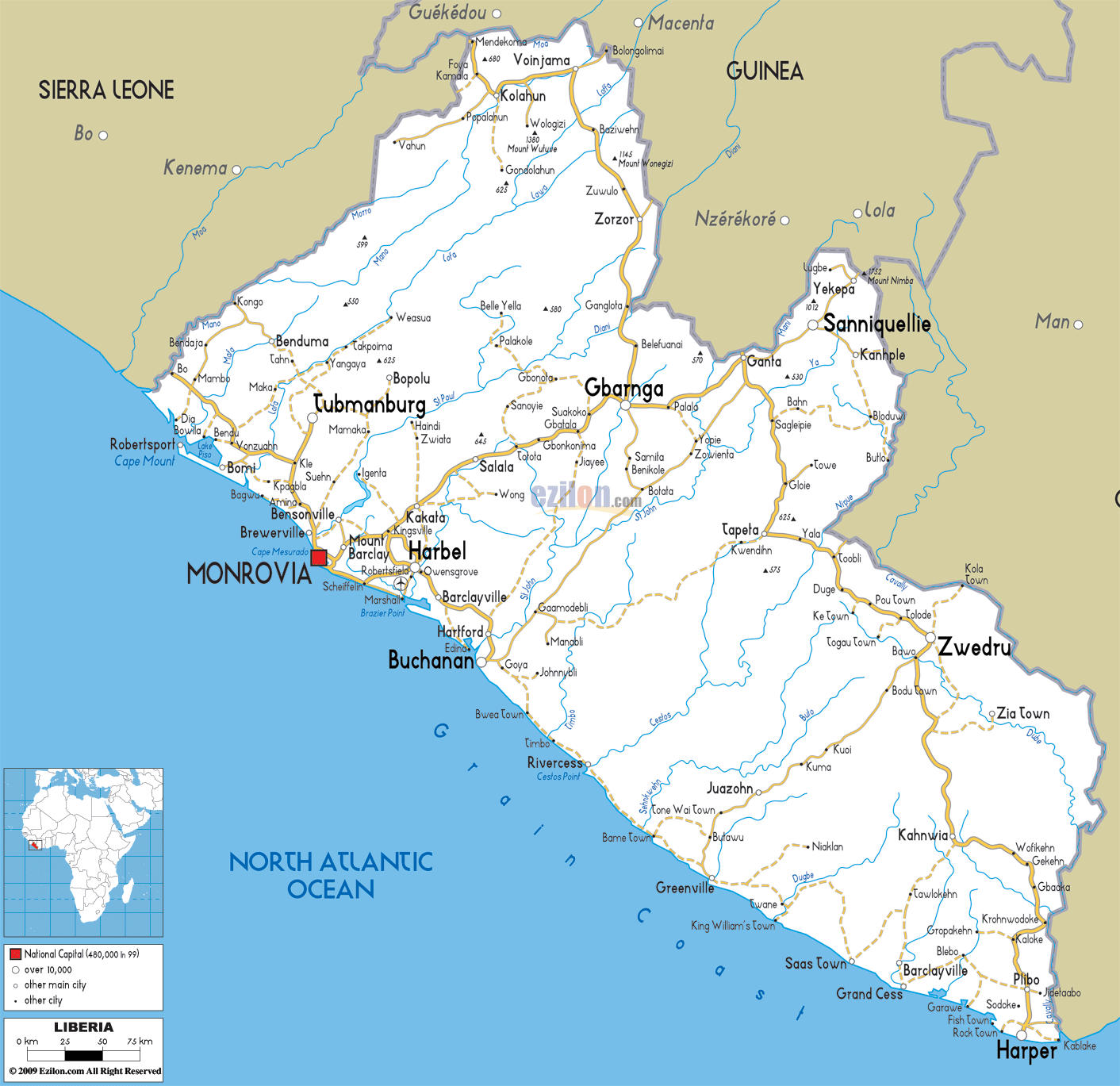
Description: Detailed clear large road map of Liberia with road routes from cities to towns, road intersections to provinces and perfectures.
 Liberia
is located in West Africa and shares its borders with
Sierra Leone, Guinea Republic and Côte d'Ivoire. It
overlooks the Atlantic Ocean with a long stretch of
coastline, half of which is composed of sandy beaches.
Monrovia is its capital and the official language is
English, although the languages spoken by the population
are Bassa, Dan and Kru amongst other 30 odd African
languages.
Liberia
is located in West Africa and shares its borders with
Sierra Leone, Guinea Republic and Côte d'Ivoire. It
overlooks the Atlantic Ocean with a long stretch of
coastline, half of which is composed of sandy beaches.
Monrovia is its capital and the official language is
English, although the languages spoken by the population
are Bassa, Dan and Kru amongst other 30 odd African
languages.
The people from Liberia are called Liberians.

Political Map of Liberia
Political map and map image of Liberia.

Physical Map of Liberia
Physical map and map image of Liberia.

Regional Directory of United States of America
Information and guide about United States of America and websites with American topics.

Regional Directory of Europe
Information and guide about Europe and websites with European topics.

Regional Directory of Australia
Information and guide about Australia and websites with Australian topics.