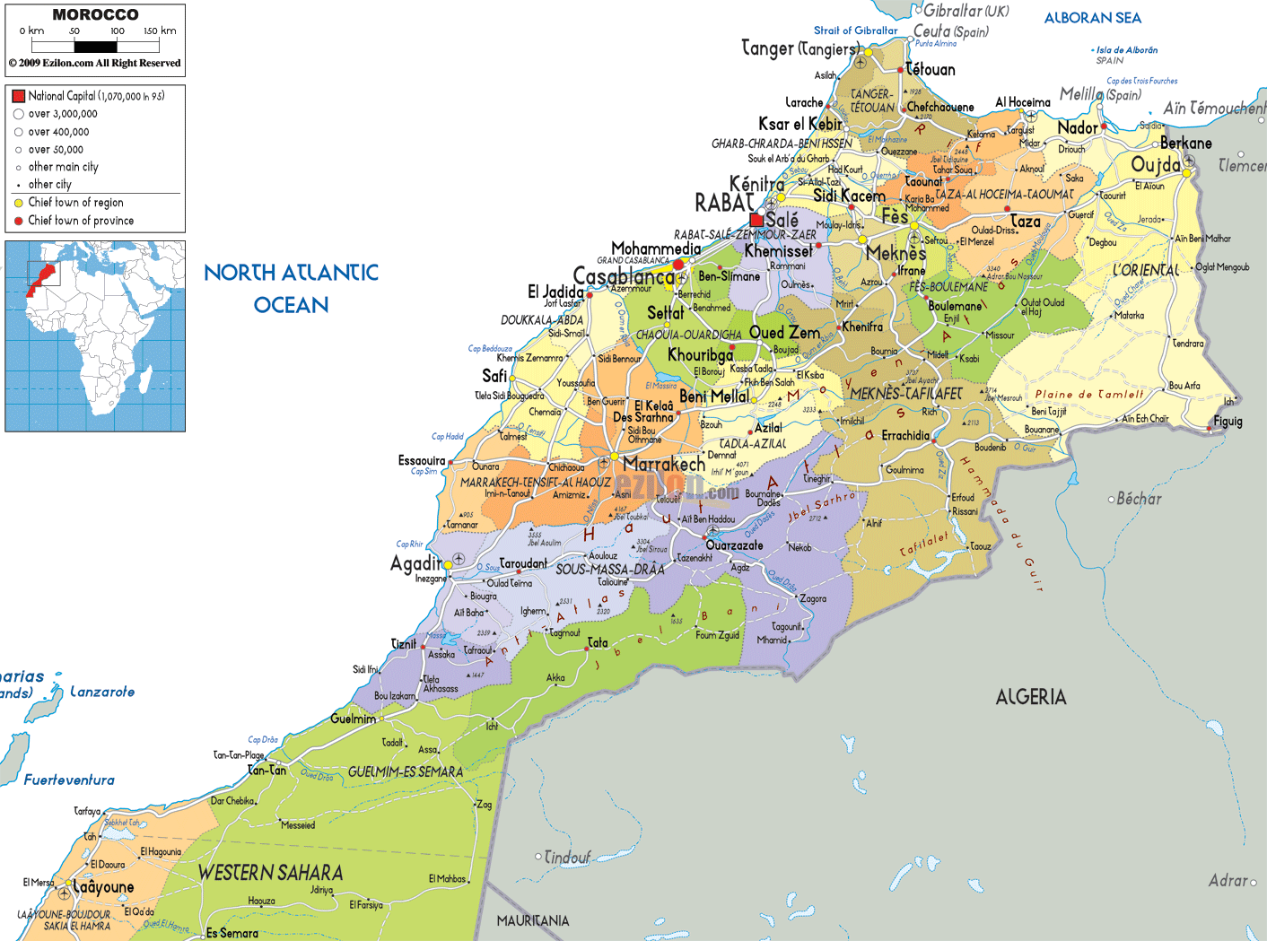
Description: Detailed large political map of Morocco showing names of capital cities, towns, states, provinces and boundaries with neighbouring countries.
 Morocco,
a country that is situated in North Africa has a land
area of about 447,000 square kilometers and its
population is thirty-two million people approximately.
Casablanca is the largest city in Morocco and Rabat is
its capital city. Algeria is located on its east,
Mauritania is located on its south and Spain is situated
on the north. Morocco experiences Mediterranean climate.
About twelve percent of the land is covered by forests
and eighteen percent of the land in the country is used
for the purpose of agriculture.
Morocco,
a country that is situated in North Africa has a land
area of about 447,000 square kilometers and its
population is thirty-two million people approximately.
Casablanca is the largest city in Morocco and Rabat is
its capital city. Algeria is located on its east,
Mauritania is located on its south and Spain is situated
on the north. Morocco experiences Mediterranean climate.
About twelve percent of the land is covered by forests
and eighteen percent of the land in the country is used
for the purpose of agriculture.
The people from Morocco are called Moroccans.

Physical Map of Morocco
Physical map and map image of Morocco.

Road Map of Morocco
Road map and map image of Morocco.

Regional Directory of United States of America
Information and guide about United States of America and websites with American topics.

Regional Directory of Europe
Information and guide about Europe and websites with European topics.

Regional Directory of Australia
Information and guide about Australia and websites with Australian topics.