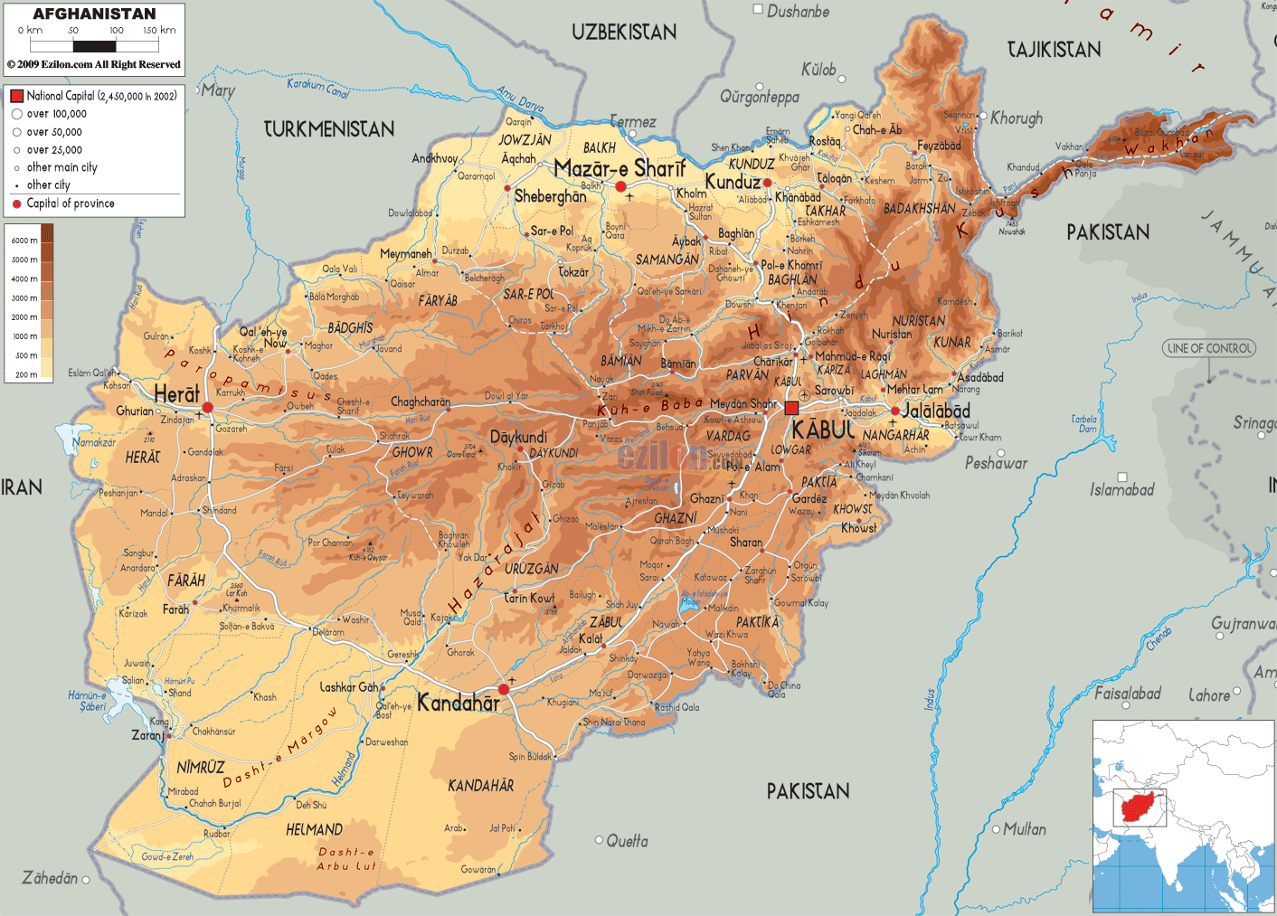
Description: The Physical Map of Afghanistan showing major geographical features like elevations, mountain ranges, deserts, lakes, plateaus, peninsulas, rivers, plains, landforms and other topographic features.
This map of Afghanistan with mountains, hills, lakes, rivers and other terrains is already large enough to read directly on your desktop. To see a full-screen zoom view on a phone or tablet, tap the map image (or tap the Zoom Map label above the image). Scan by shading provinces in various colored blocks, with Afghanistan's mountains, hills, lakes and rivers in bold.
 Detailed Physical map of Afghanistan showing mountains (the Hindu Kush), plateaus and rivers, elevations and other topographic features. Afghanistan's physical landscape borders Pakistan, Iran, Turkmenistan, Uzbekistan, Tajikistan and China. Located
in Central Asia and South Asia, Afghanistan officially
known as the Islamic Republic of Afghanistan is a
landlocked country. With an area of 652,000 km2 (252,000
sq mi), it has Pakistan in the south and east; Iran in
the west; Uzbekistan, Turkmenistan, and Tajikistan in
the north; and China in the far northeast.
Detailed Physical map of Afghanistan showing mountains (the Hindu Kush), plateaus and rivers, elevations and other topographic features. Afghanistan's physical landscape borders Pakistan, Iran, Turkmenistan, Uzbekistan, Tajikistan and China. Located
in Central Asia and South Asia, Afghanistan officially
known as the Islamic Republic of Afghanistan is a
landlocked country. With an area of 652,000 km2 (252,000
sq mi), it has Pakistan in the south and east; Iran in
the west; Uzbekistan, Turkmenistan, and Tajikistan in
the north; and China in the far northeast.
It lies between latitudes 29° N and 39° N, and
longitudes 60° E and 75° E. Noshaq, at 7,492 m (24,580
ft) above sea level is the highest peak of Afghanistan.
Most of the parts of the country are dry, despite having
numerous rivers and reservoirs. One of the driest
regions in the world is situated in Afghanistan in the
endorheic region of Sistan Basin.
The north-eastern Hindu Kush mountain range is an area
where destructive and deadly earthquakes are frequent.
Afghanistan is world's 41st largest nation. Maximum
parts of the country are dry, despite having numerous
rivers and reservoirs.

Political Map of Afghanistan
Political map and map image of Afghanistan.

Road Map of Afghanistan
Road map and map image of Afghanistan.

Regional Directory of United States of America
Information and guide about United States of America and websites with American topics.

Regional Directory of Europe
Information and guide about Europe and websites with European topics.

Regional Directory of Australia
Information and guide about Australia and websites with Australian topics.
