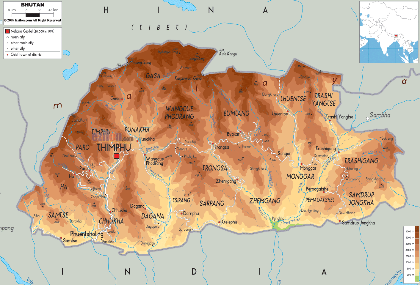
Description: The Physical Map of Bhutan showing major geographical features like elevations, mountain ranges, deserts, seas, lakes, plateaus, peninsulas, rivers, plains, landforms and other topographic features.
 Bhutan
is located at the eastern end of the Himalayas. It is
situated in South Asia and is surrounded by China to its
north and to its south, east and west directions by
India.
Bhutan
is located at the eastern end of the Himalayas. It is
situated in South Asia and is surrounded by China to its
north and to its south, east and west directions by
India.
The country is landlocked between the Indian states of
West Bengal, Sikkim, Arunachal Pradesh and Assam. Its
topography features mostly the rugged steep and high
mountains.
The alpine shrubs and meadows of the eastern Himalayas
form an arc in the northern region. The Black Mountains
act as a watershed between the river systems of the
DrangmeChhu and the Mo Chhu. The southern region is
covered by the Shivalik range which descend into the
plains of Duars.
The main rivers of Bhutan are the Torsa, the Sankosh,
the Raidak and the Manas. All these rivers merge into
the Brahmaputra River in India. About 65% area of Bhutan
is densely covered by forests.

Political Map of Bhutan
Political map and map image of Bhutan.

Road Map of Bhutan
Road map and map image of Bhutan.

Regional Directory of United States of America
Information and guide about United States of America and websites with American topics.

Regional Directory of Europe
Information and guide about Europe and websites with European topics.

Regional Directory of Australia
Information and guide about Australia and websites with Australian topics.