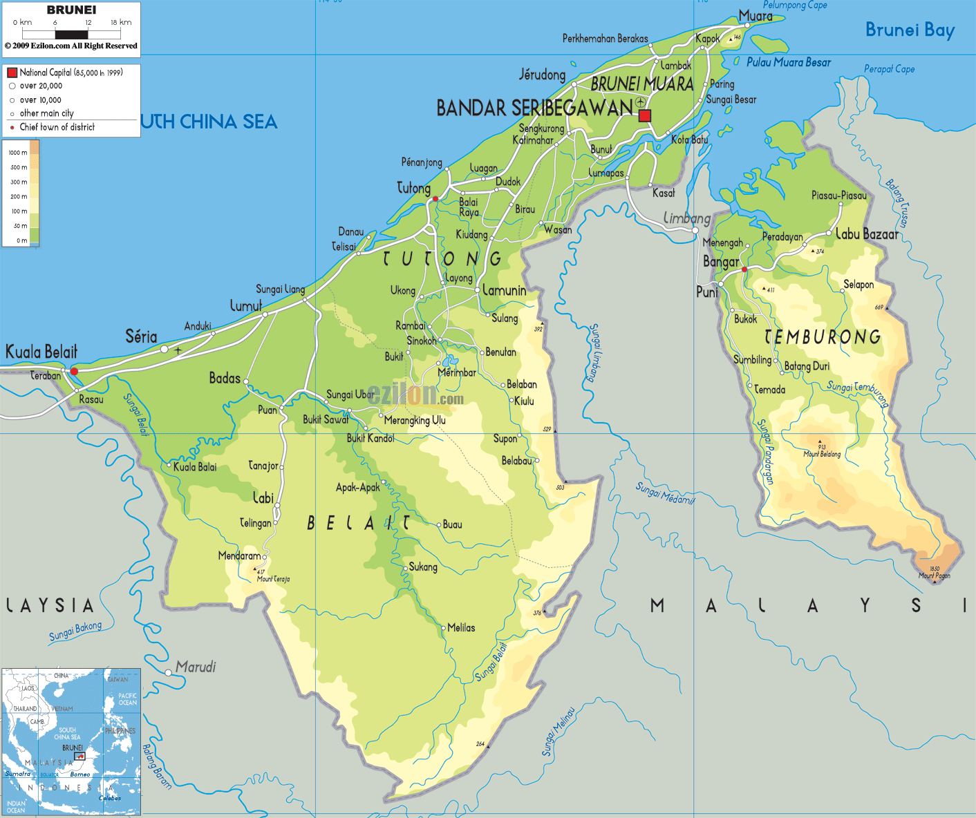
Description: The Physical Map of Brunei showing major geographical features like elevations, mountain ranges, seas, lakes, plateaus, peninsulas, rivers, plains, landforms and other topographic features.
 The
Nation of Brunei, the Abode of Peace is the official
name of Brunei is located in Southeast Asia on the north
coast of the island of Borneo. The Sarawak district of
Limbang divides it into two parts. It has a coastline
with the South China Sea and surrounded by the state of
Sarawak, Malaysia.
The
Nation of Brunei, the Abode of Peace is the official
name of Brunei is located in Southeast Asia on the north
coast of the island of Borneo. The Sarawak district of
Limbang divides it into two parts. It has a coastline
with the South China Sea and surrounded by the state of
Sarawak, Malaysia.
With a total area of 5,765 square kilometres (2,226 sq
mi) it is made up of two unconnected parts. The
coastline of Brunei next to the South China Sea is 161
kilometres (100 mi) and its border with Malaysia is 381
km (237 mi). It has 500 square kilometres (193 sq mi) of
territorial waters.
The larger western part of Brunei is densely populated
and the mountainous eastern part is less populated.
Bandar Seri Begawan is the capital of Brunei.

Political Map of Brunei
Political map and map image of Brunei.

Road Map of Brunei
Road map and map image of Brunei.

Regional Directory of United States of America
Information and guide about United States of America and websites with American topics.

Regional Directory of Europe
Information and guide about Europe and websites with European topics.

Regional Directory of Australia
Information and guide about Australia and websites with Australian topics.