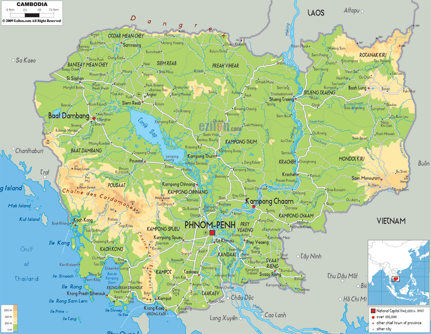
Description: The Physical Map of Cambodia showing major geographical features like elevations, mountain ranges, deserts, ocean, lakes, plateaus, peninsulas, rivers, plains, landforms and other topographic featuress.
This map of Cambodia with mountains, hills, lakes, rivers and other terrains is already large enough to read directly on your desktop. To see a full-screen zoom view on a phone or tablet, tap the map image (or tap the Zoom Map label above the image). Scan by shading provinces in various colored blocks, with Cambodia's mountains, hills, lakes and rivers in bold.
 Detailed Physical map of Cambodia showing rivers (the Mekong), lakes (Tonle Sap) and plains, elevations and other topographic features. Cambodia's terrain connects with neighboring Thailand, Laos, and Vietnam.
The countries which surround Cambodia are Laos to the
northeast, the Gulf of Thailand to the southwest,
Vietnam to the east, and Thailand to the northwest. It
has low-lying central plain with uplands and low
mountains around.
Mekong River is the main river of the country and it
flows from east to south of the country. In the east the
country has highlands which get merged into plains
towards the west. They run into Laos and Vietnam and
consists of forests area and plateaus.
The Damrei Mountains and the Krâvanh Mountains are
another major highlands blocks. The country’s southern
region is very less populated and is separated from the
main plains by the highlands of southwest. This region
is along the Gulf of Thailand.

Political Map of Cambodia
Political map and map image of Cambodia.

Road Map of Cambodia
Road map and map image of Cambodia.

Regional Directory of United States of America
Information and guide about United States of America and websites with American topics.

Regional Directory of Europe
Information and guide about Europe and websites with European topics.

Regional Directory of Australia
Information and guide about Australia and websites with Australian topics.
