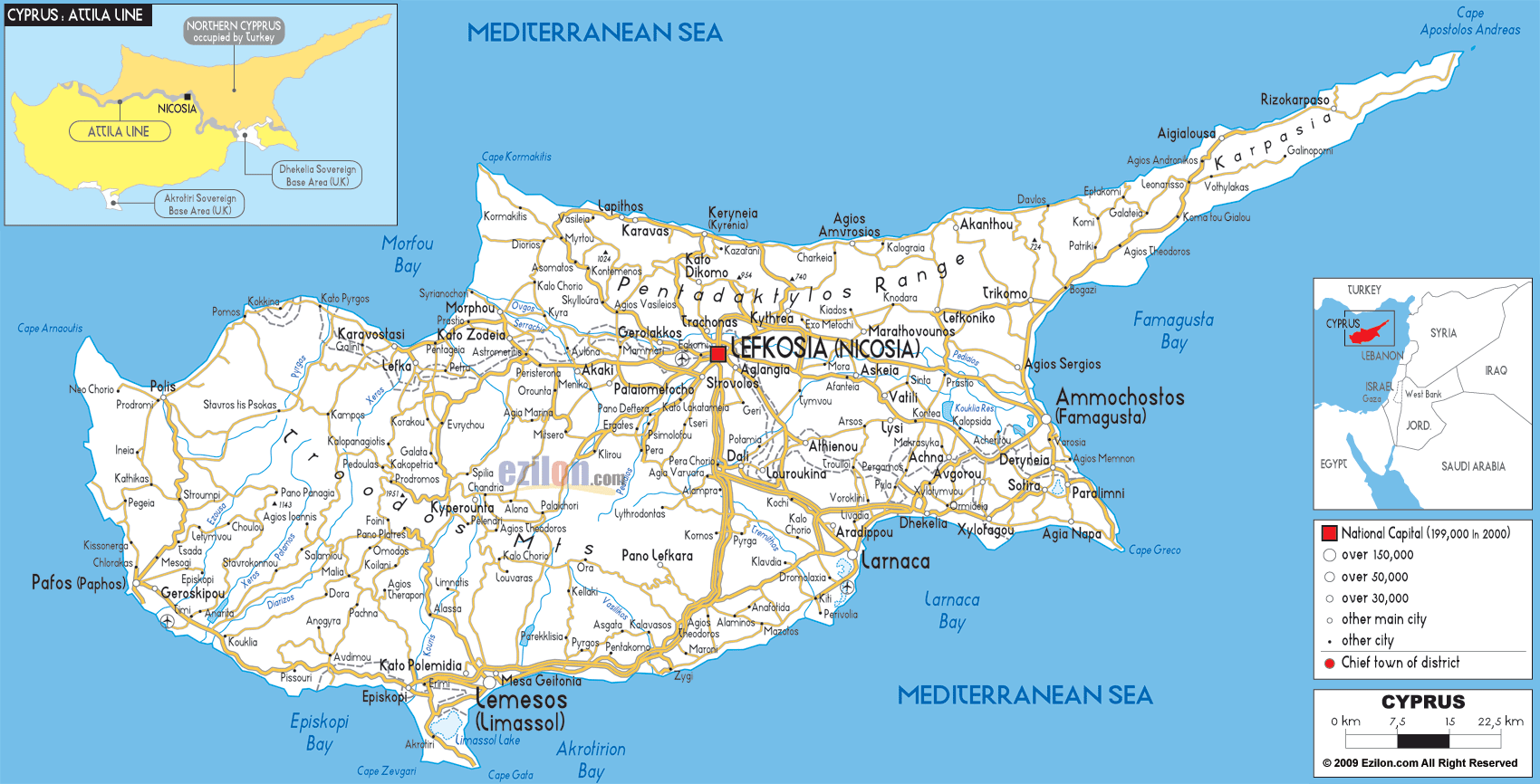
Description: Detailed clear large road map of Cyprus with road routes from cities to towns, road intersections to provinces and perfectures.
 Cyprus roads and motorways are well connected, and almost all roads and highways lead to Lefkosia (Nicosia) its capital city.
There are good roads connecting the coastal towns of Lapithos, Keryneia, Agios Amvrosios, Davlos to all the way to Aigialousa and Rizokarpaso.
The A1 motorways connecting Lemesos (Limassol) to Nicosia also pass small towns and villages like Theodoros, Komos, Agia Varvaria and Per Choria.
A3 motorway connects Larnaca Airport to Agia Napa on the South East.
The roads in the southern part of Cyprus stretch all the way from Pafos (Paphos) to Geroskipou, Pissouri, Episkopi, Limassol, Zygi, Larnaca, Dhelelia and up to Ammochostos (Famagusta) on the east coast of Cyprus. A7 motorways connect Pafos to Polis, A2 connects A1 near Pera Chorio with A3 by Larnaca .

Physical Map of Cyprus
Physical map and map image of Cyprus.

Political Map of Cyprus
Political map and map image of Cyprus.

Regional Directory of United States of America
Information and guide about United States of America and websites with American topics.

Regional Directory of Europe
Information and guide about Europe and websites with European topics.

Regional Directory of Australia
Information and guide about Australia and websites with Australian topics.