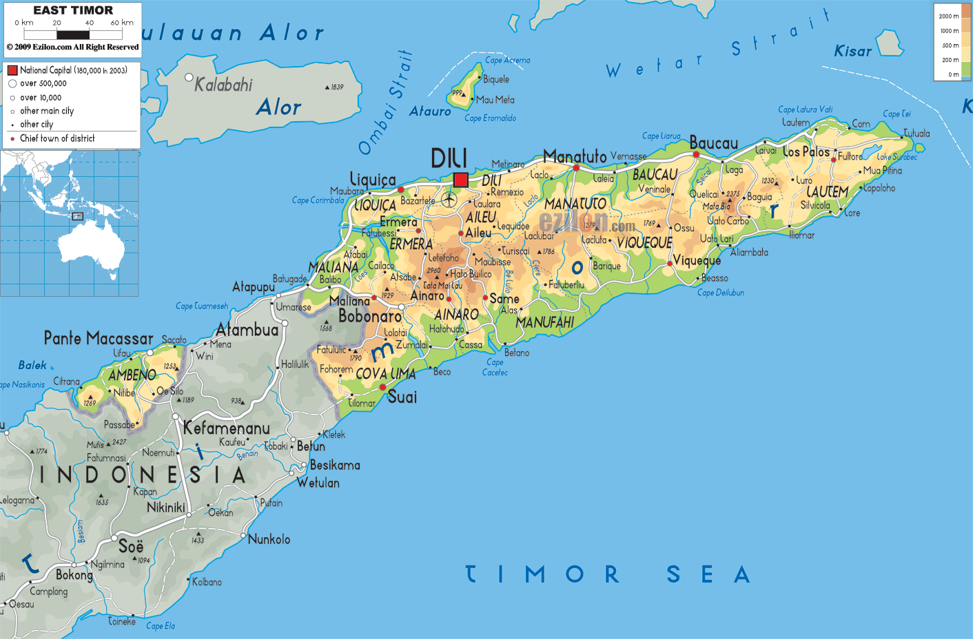
Description: The Physical Map of East Timor showing major geographical features like elevations, mountain ranges, deserts, ocean, lakes, plateaus, peninsulas, rivers, plains, landforms and other topographic features.
This map of East Timor with mountains, hills, lakes, rivers and other terrains is already large enough to read directly on your desktop. To see a full-screen zoom view on a phone or tablet, tap the map image (or tap the Zoom Map label above the image). Scan by shading municipalities in various colored blocks, with East Timor's mountains, hills, lakes and rivers in bold.
 Detailed Physical map of East Timor showing mountains and coastline, elevations and other topographic features. East Timor shares the island of Timor with neighboring Indonesia.
The eastern half of the island of Timor have the nearby
islands are Jaco, Atauro and Oecusse composes East timor.
15,410 square kilometres is the total area it has.
Tatamailau (also known as Mount Ramelau) at 2,963 metres
is its highest point. The county's first conservation
area, the Nino Konis Santana National Park is situated
at easternmost area of East Timor which consists of the
Paitchau Range and the Lake Ira Lalaro area.
A number of unique plant and animal species are found
there. But this region is has very less population. A
number of coral reef systems are also found at the
northern coast.
The country of East Timor is mostly composed of
mountains. The lowest points are Timor Sea and Savu Sea.
Natural gas, petroleum, manganese, gold and marble are
its natural recourses.

Political Map of East Timor
Political map and map image of East Timor.

Road Map of East Timor
Road map and map image of East Timor.

Regional Directory of United States of America
Information and guide about United States of America and websites with American topics.

Regional Directory of Europe
Information and guide about Europe and websites with European topics.

Regional Directory of Australia
Information and guide about Australia and websites with Australian topics.
