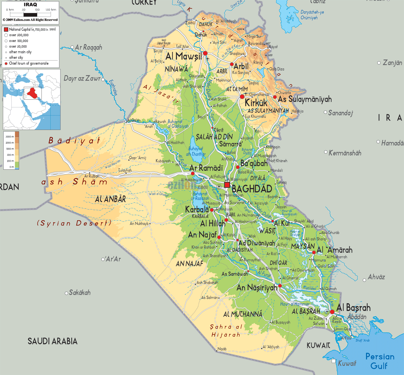
Description: The Physical Map of Iraq showing major geographical features like elevations, mountain ranges, deserts, gulf, lakes, plateaus, peninsulas, rivers, plains, landforms and other topographic features.
 Iraq
with the official name as the Republic of Iraq is
situated in Western Asia bordering Jordan to the
southwest, Turkey to the north, Syria to the west,
Kuwait to the southeast, Iran to the east, Saudi Arabia
to the south.
Iraq
with the official name as the Republic of Iraq is
situated in Western Asia bordering Jordan to the
southwest, Turkey to the north, Syria to the west,
Kuwait to the southeast, Iran to the east, Saudi Arabia
to the south.
With total area of 437,072 square kilometres, it is the
58th-largest country in the world. It is that of the
size of California in the United States and is bigger
than Praguay.
Desert is the main feature of Iraq. About forty percent
of the country is covered by rocks and deserts. But the
southern Iraq is damp and marshy.
Euphrates and Tigris are two major rivers and are
fertile alluvial plains. They flow from north to south
i.e. from the highlands towards the Gulf of Persia.
60,000,000 m3 of silt is carried by these rivers to the delta annually. Locally known as Cheekah Dar (black tent) it is the highest point in Iraq. There is no official name given to this point.
The northern country mostly consists of mountains only.
The coastline of Iraq is very small measuring 58 km
along the Persian Gulf. Near the Shatt al-Arab and the
coastline there were marshlands but they got drained in
1990.

Political Map of Iraq
Political map and map image of Iraq.

Road Map of Iraq
Road map and map image of Iraq.

Regional Directory of United States of America
Information and guide about United States of America and websites with American topics.

Regional Directory of Europe
Information and guide about Europe and websites with European topics.

Regional Directory of Australia
Information and guide about Australia and websites with Australian topics.