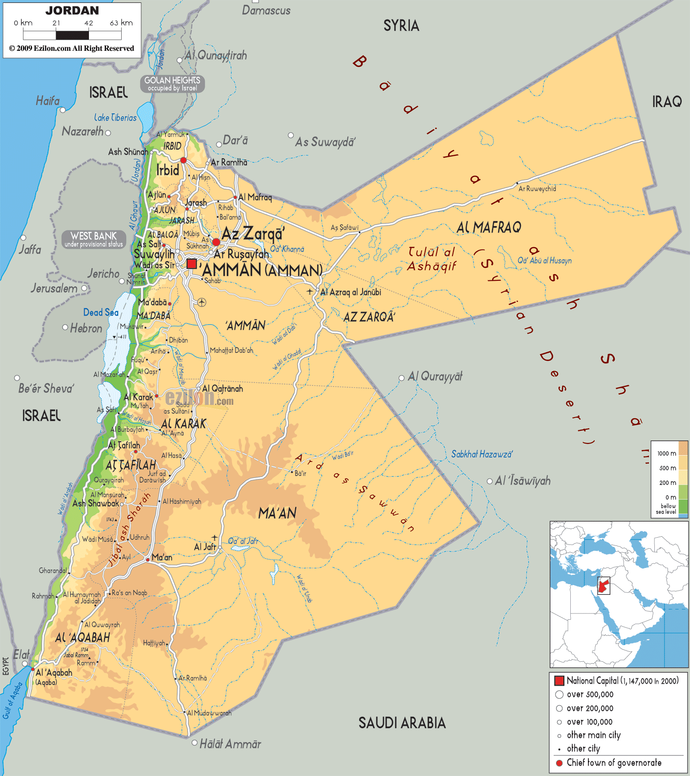
Description: The Physical Map of Jordan showing major geographical features like elevations, mountain ranges, deserts, gulf Aqaba, lakes, plateaus, peninsulas, rivers, plains, landforms and other topographic features.
 Officially
known as the Hashemite Kingdom of Jordan, a kingdom of
Arab, Jordan is situated in west Asia on the banks of
the river Jordan. It shares boundaries with Syria to the
north, Saudi Arabia to the south and east, Palestine and
Israel to the west and Iraq to the north-east. Its total
land area is 89,342 square kilometres. It also has a
coastline of twenty six kilometres.
Officially
known as the Hashemite Kingdom of Jordan, a kingdom of
Arab, Jordan is situated in west Asia on the banks of
the river Jordan. It shares boundaries with Syria to the
north, Saudi Arabia to the south and east, Palestine and
Israel to the west and Iraq to the north-east. Its total
land area is 89,342 square kilometres. It also has a
coastline of twenty six kilometres.
Jordan is almost the landlocked country with a small
coastline along the Gulf of Aqaba. The Eastern Plateau,
the Jordan Valley and the desert are the main features
of Jordan.
Jabal Umm al Dami is the highest point of the country at
an elevation of 1,854 metres. Snow can be found on the
top of this peak. Dead Sea at −420 metres is the lowest
point of the country. Jordan is included in the region
which is called the cradle of civilization meaning the
area of Fertile Crescent.

Political Map of Jordan
Political map and map image of Jordan.

Road Map of Jordan
Road map and map image of Jordan.

Regional Directory of United States of America
Information and guide about United States of America and websites with American topics.

Regional Directory of Europe
Information and guide about Europe and websites with European topics.

Regional Directory of Australia
Information and guide about Australia and websites with Australian topics.