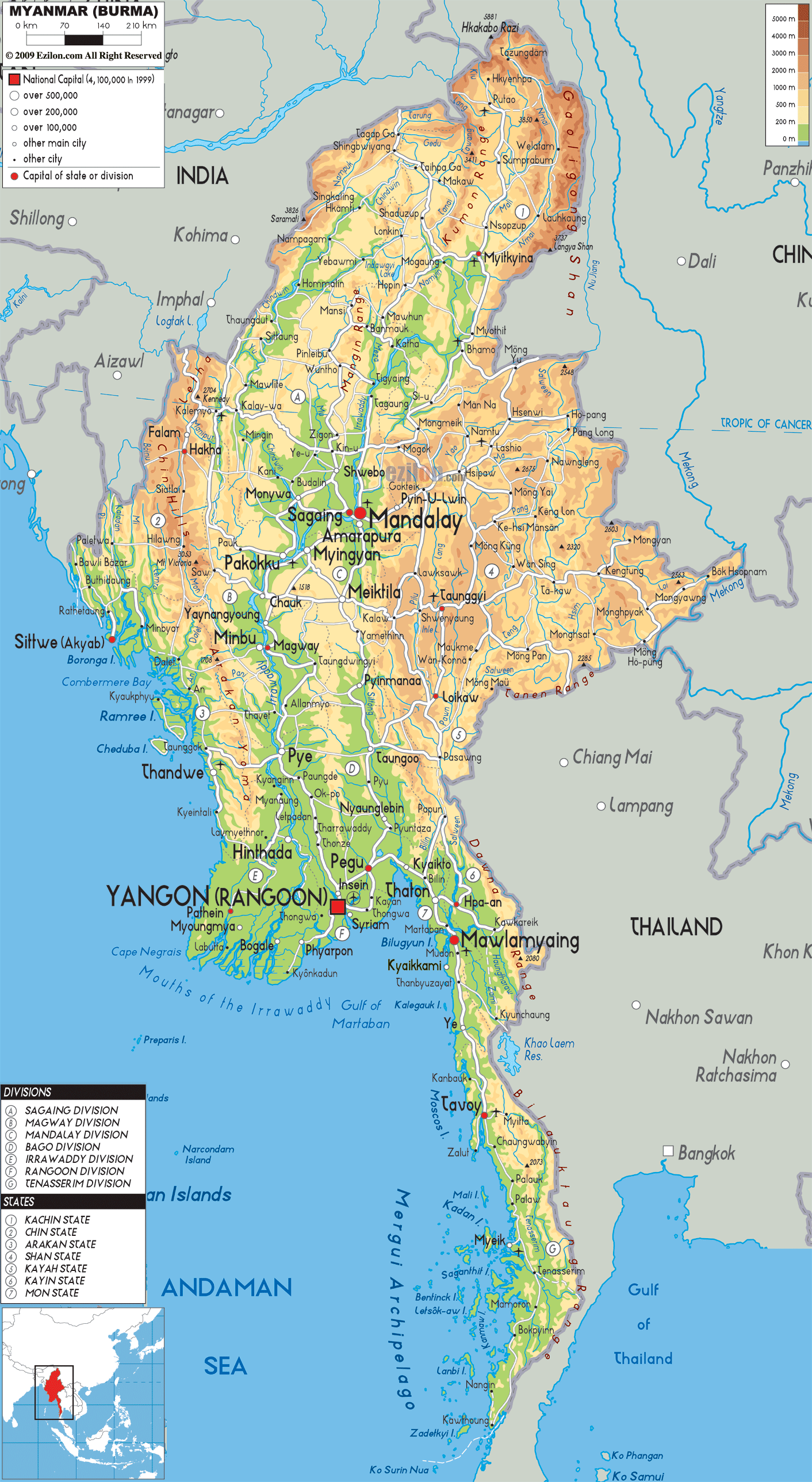

Description: The Physical Map of Myanmar showing major geographical features like elevations, mountain ranges, deserts, seas, lakes, plateaus, peninsulas, rivers, plains, landforms and other topographic features.
 Originally
known as Burma, Myanmar is officially known as the
Republic of the Union of Myanmar. It is situated in
Southeast Asia and it shares borders with India, China,
Thailand, Laos and Bangladesh. 676,578 square kilometres
is the total area of the country and the length of the
coastline is 1,930 kilometres which runs along the
Andaman Sea and the Bay of Bengal.
It is the 40th largest country in the world. In
Southeast Asia it is the second largest country. It
shares border with Chittagong Division of Bangladesh and
the states of India- Manipur, Mizoram, Arunachal Pradesh
and Nagaland. To the southeast it is surrounded by Laos
and Thailand.
The three rivers namely- Salween (Thanlwin), Irrawaddy
and Sittaung are divided by these mountain ranges.
Nearly 2,170 kilometres the Irrawaddy River is the main
and longest river of Myanmar. The Irrawaddy valley is
densely populated and is situated between the Shan
Plateau and the Rakhine Yoma.

Political Map of Myanmar
Political map and map image of Myanmar.

Road Map of Myanmar
Road map and map image of Myanmar.

Regional Directory of United States of America
Information and guide about United States of America and websites with American topics.

Regional Directory of Europe
Information and guide about Europe and websites with European topics.

Regional Directory of Australia
Information and guide about Australia and websites with Australian topics.